La Puebla de Montalbán geodata
La Puebla de Montalbán (Castille-La Mancha) is a populated place; located in Spain in Europe/Madrid (GMT+2) time zone. With population of 7,695 people, there are 964 cities with bigger population in this country. Compared to other cities in Spain, 72.2% of cities are located further ↑North; 64.4% of cities are located further →East and 62.7% of cities have higher elevation than La Puebla de Montalbán. Note1
Current local time in La Puebla de Montalbán:
10:44 PM, ThursdayDifference from your time zone: hours


La Puebla de Montalbán GPS coordinates[2]
39° 51' 46.692" North, 4° 21' 33.012" West
| Map corner | latitude | longitude |
|---|---|---|
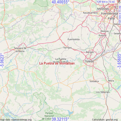
| Upper-left | 40.40055°, | -5.0623° |
| Center: | 39.86297°, | -4.35917° |
| Lower-right: | 39.32115°, | -3.65605° |
| Map W x H: | 120×120 km | = 74.6×74.6mi |
| max Lat: | 43.74134° ⇑72.2% North |
| La Puebla de Montalbán: | 39.86297° |
| min Lat: | ⇓27.8% South 27.64134° |
| min Long | La Puebla de Mo | max Long |
| -18.00367° | -4.35917° | 4.2899° |
| W 35.6%⇐ | ⇒64.4% E |
Elevation
Elevation of La Puebla de Montalbán is 490 m = 1608 ft, and this is 108 m = 354 ft below average elevation for this country.
| Max E: |
1682 m = 5518 ft | 62.7% |
| Avg. | 598 m = 1962 ft | |
| La Puebla de Montalbán | 490 m = 1608 ft | |
Min E: |
0 m = 0 ft | 37.3% |
See also: Spain elevation on elevation.city.
Geographical zone
La Puebla de Montalbán is located in North temperate zone (between Tropic of Cancer and the Arctic Circle). Distance of this Northern Tropic circle is 1826.4 km =1134.9 mi to South.| Distance of | km | miles | from La Puebla de Montalbán |
|---|---|---|---|
| North Pole | 5574.7 | 3464 | to North |
| Arctic Circle | 2968.8 | 1844.7 | to North |
| Tropic Cancer | 1826.4 | 1134.9 | to South |
| Equator | 4432.3 | 2754.1 | to South |


Nearby cities:
15 places around La Puebla de Montalbán: (largest is in red/bold)
• Albarreal de Tajo
11.7 km =7.3 mi,  71°
71°
• Alcabón
15.5 km =9.6 mi,  357°
357°
• Barcience
17.1 km =10.6 mi,  38°
38°
• Burujón
6.8 km =4.2 mi,  51°
51°
• Carmena
10.9 km =6.8 mi,  340°
340°
• Carriches
14.1 km =8.8 mi,  322°
322°
• Domingo Pérez
17.8 km =11.1 mi, 315°
• El Carpio de Tajo
8.5 km =5.3 mi,  288°
288°
• Erustes
15.7 km =9.8 mi,  311°
311°
• Escalonilla
7 km =4.3 mi,  5°
5°
• Gerindote
12.4 km =7.7 mi,  22°
22°
• La Mata
11 km =6.8 mi, 322°
• Malpica
16.7 km =10.4 mi,  283°
283°
• Rielves
18 km =11.2 mi, 52°
• Torrijos
14.7 km =9.1 mi,  26°
26°
Sources, notices
• [Note1] Compared only with cities in Spain existing in our database
• [Src1] Map data: © OpenStreetMap contributors (CC-BY-SA)
• [Src2] Other city data from geonames.org with taken over terms of usage.
• [Src3] Geographical zone / Annual Mean Temperature by Robert A. Rohde @ Wikipedia
