Villanueva de Algaidas geodata
Villanueva de Algaidas (Andalusia) is a seat of a third-order administrative division; located in Spain in Europe/Madrid (GMT+2) time zone. With population of 4,421 people, there are 1398 cities with bigger population in this country. Compared to other cities in Spain, 94.2% of cities are located further ↑North; 65.5% of cities are located further →East and 58.1% of cities have higher elevation than Villanueva de Algaidas. Note1
Administrative division(s):
- Level 1: Andalusia
- Level 2: Provincia de Málaga
- Level 3: Villanueva de Algaidas
Current local time in Villanueva de Algaidas:
09:15 PM, ThursdayDifference from your time zone: hours


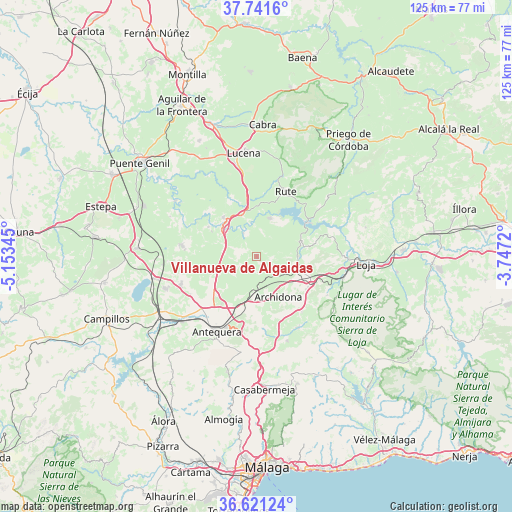
Villanueva de Algaidas GPS coordinates[2]
37° 11' 0.6" North, 4° 27' 1.152" West
| Map corner | latitude | longitude |
|---|---|---|
| Upper-left | 37.7416°, | -5.15345° |
| Center: | 37.1835°, | -4.45032° |
| Lower-right: | 36.62124°, | -3.7472° |
| Map W x H: | 124.6×124.6 km | = 77.4×77.4mi |
| max Lat: | 43.74134° ⇑94.2% North |
| Villanueva de Algaidas: | 37.1835° |
| min Lat: | ⇓5.8% South 27.64134° |
| min Long | Villanueva de A | max Long |
| -18.00367° | -4.45032° | 4.2899° |
| W 34.5%⇐ | ⇒65.5% E |
Elevation
Elevation of Villanueva de Algaidas is 551 m = 1808 ft, and this is 47 m = 154 ft below average elevation for this country.
| Max E: |
1682 m = 5518 ft | 58.1% |
| Avg. | 598 m = 1962 ft | |
| Villanueva de Algaidas | 551 m = 1808 ft | |
Min E: |
0 m = 0 ft | 41.9% |
See also: Spain elevation on elevation.city.
Geographical zone
Villanueva de Algaidas is located in North temperate zone (between Tropic of Cancer and the Arctic Circle). Distance of this Northern Tropic circle is 1528.5 km =949.8 mi to South.| Distance of | km | miles | from Villanueva de Algaidas |
|---|---|---|---|
| North Pole | 5872.6 | 3649.1 | to North |
| Arctic Circle | 3266.8 | 2029.9 | to North |
| Tropic Cancer | 1528.5 | 949.8 | to South |
| Equator | 4134.4 | 2569 | to South |


Nearby cities:
15 places around Villanueva de Algaidas: (largest is in red/bold)
• Alameda
18.7 km =11.6 mi,  278°
278°
• Antequera
20.7 km =12.9 mi,  208°
208°
• Archidona
11.1 km =6.9 mi,  150°
150°
• Benamejí
12.4 km =7.7 mi,  319°
319°
• Cuevas Bajas
6.6 km =4.1 mi,  330°
330°
• Cuevas de San Marcos
9.8 km =6.1 mi,  19°
19°
• Encinas Reales
10.6 km =6.6 mi,  341°
341°
• Humilladero
23.7 km =14.7 mi,  250°
250°
• Iznájar
15 km =9.3 mi,  56°
56°
• Mollina
19.4 km =12.1 mi, 250°
• Palenciana
13.8 km =8.6 mi,  301°
301°
• Rute
17.5 km =10.9 mi, 24°
• Villanueva de Tapia
10.3 km =6.4 mi,  90°
90°
• Villanueva del Rosario
22.1 km =13.7 mi,  160°
160°
• Villanueva del Trabuco
19.9 km =12.4 mi, 150°
Sources, notices
• [Note1] Compared only with cities in Spain existing in our database
• [Src1] Map data: © OpenStreetMap contributors (CC-BY-SA)
• [Src2] Other city data from geonames.org with taken over terms of usage.
• [Src3] Geographical zone / Annual Mean Temperature by Robert A. Rohde @ Wikipedia
