Velez Rubio geodata
Velez Rubio (Andalusia) is a populated place; located in Spain in Europe/Madrid (GMT+2) time zone. With population of 7,045 people, there are 1033 cities with bigger population in this country. Compared to other cities in Spain, 90.4% of cities are located further ↑North; 66.5% of cities are located further ←West and 72.1% of cities have lower elevation than Velez Rubio. Note1


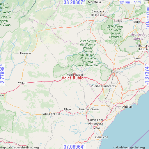
Velez Rubio GPS coordinates[2]
37° 38' 54.384" North, 2° 4' 36.696" West
| Map corner | latitude | longitude |
|---|---|---|
| Upper-left | 38.20307°, | -2.77999° |
| Center: | 37.64844°, | -2.07686° |
| Lower-right: | 37.08964°, | -1.37374° |
| Map W x H: | 123.8×123.8 km | = 76.9×76.9mi |
| max Lat: | 43.74134° ⇑90.4% North |
| Velez Rubio: | 37.64844° |
| min Lat: | ⇓9.6% South 27.64134° |
| min Long | Velez Rubio | max Long |
| -18.00367° | -2.07686° | 4.2899° |
| W 66.5%⇐ | ⇒33.5% E |
Elevation
Elevation of Velez Rubio is 828 m = 2717 ft, and this is 230 m = 755 ft above average elevation for this country.
| Max E: |
1682 m = 5518 ft | 27.9% |
| Velez Rubio | 828 m 2717 ft | |
| Avg. | 598 m = 1962 ft | |
Min E: |
0 m = 0 ft | 72.1% |
See also: Spain elevation on elevation.city.
Geographical zone
Velez Rubio is located in North temperate zone (between Tropic of Cancer and the Arctic Circle). Distance of this Northern Tropic circle is 1580.2 km =981.9 mi to South.| Distance of | km | miles | from Velez Rubio |
|---|---|---|---|
| North Pole | 5820.9 | 3616.9 | to North |
| Arctic Circle | 3215.1 | 1997.8 | to North |
| Tropic Cancer | 1580.2 | 981.9 | to South |
| Equator | 4186.1 | 2601.1 | to South |


Nearby cities:
15 places around Velez Rubio: (largest is in red/bold)
• Albox
29.6 km =18.4 mi,  192°
192°
• Arboleas
33.2 km =20.6 mi,  179°
179°
• Cantoria
34.6 km =21.5 mi,  197°
197°
• Chirivel
17.9 km =11.1 mi,  250°
250°
• Fines
35.8 km =22.2 mi,  206°
206°
• Huércal-Overa
31.2 km =19.4 mi,  157°
157°
• La Torrecilla
30.9 km =19.2 mi,  95°
95°
• Lorca
33.1 km =20.6 mi,  85°
85°
• María
10.3 km =6.4 mi,  311°
311°
• Oria
26.3 km =16.3 mi,  226°
226°
• Partaloa
29.8 km =18.5 mi, 206°
• Puerto Lumbreras
25.4 km =15.8 mi,  111°
111°
• Taberno
20 km =12.4 mi, 180°
• Vélez-Blanco
5.1 km =3.2 mi,  340°
340°
• Zurgena
34.2 km =21.3 mi,  174°
174°
Sources, notices
• [Note1] Compared only with cities in Spain existing in our database
• [Src1] Map data: © OpenStreetMap contributors (CC-BY-SA)
• [Src2] Other city data from geonames.org with taken over terms of usage.
• [Src3] Geographical zone / Annual Mean Temperature by Robert A. Rohde @ Wikipedia
