Serón geodata
Serón (Andalusia) is a seat of a third-order administrative division; located in Spain in Europe/Madrid (GMT+2) time zone. With population of 2,432 people, there are 1927 cities with bigger population in this country. Compared to other cities in Spain, 92.6% of cities are located further ↑North; 60.8% of cities are located further ←West and 67.2% of cities have lower elevation than Serón. Note1


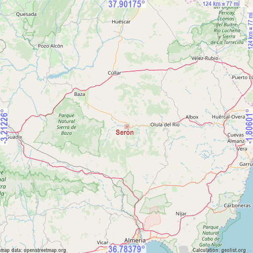
Serón GPS coordinates[2]
37° 20' 41.46" North, 2° 30' 32.868" West
| Map corner | latitude | longitude |
|---|---|---|
| Upper-left | 37.90175°, | -3.21226° |
| Center: | 37.34485°, | -2.50913° |
| Lower-right: | 36.78379°, | -1.80601° |
| Map W x H: | 124.3×124.3 km | = 77.2×77.2mi |
| max Lat: | 43.74134° ⇑92.6% North |
| Serón: | 37.34485° |
| min Lat: | ⇓7.4% South 27.64134° |
| min Long | Serón | max Long |
| -18.00367° | -2.50913° | 4.2899° |
| W 60.8%⇐ | ⇒39.2% E |
Elevation
Elevation of Serón is 793 m = 2602 ft, and this is 195 m = 640 ft above average elevation for this country.
| Max E: |
1682 m = 5518 ft | 32.8% |
| Serón | 793 m 2602 ft | |
| Avg. | 598 m = 1962 ft | |
Min E: |
0 m = 0 ft | 67.2% |
See also: Spain elevation on elevation.city.
Geographical zone
Serón is located in North temperate zone (between Tropic of Cancer and the Arctic Circle). Distance of this Northern Tropic circle is 1546.4 km =960.9 mi to South.| Distance of | km | miles | from Serón |
|---|---|---|---|
| North Pole | 5854.7 | 3637.9 | to North |
| Arctic Circle | 3248.8 | 2018.7 | to North |
| Tropic Cancer | 1546.4 | 960.9 | to South |
| Equator | 4152.4 | 2580.2 | to South |


Nearby cities:
15 places around Serón: (largest is in red/bold)
• Alcóntar
7.8 km =4.8 mi,  263°
263°
• Armuña de Almanzora
8.7 km =5.4 mi,  85°
85°
• Bayarque
6.6 km =4.1 mi,  103°
103°
• Castro de Filabres
18.8 km =11.7 mi,  161°
161°
• La Mojonera
8.6 km =5.3 mi,  132°
132°
• Laroya
16.3 km =10.1 mi,  108°
108°
• Lúcar
9.7 km =6 mi,  50°
50°
• Macael
18.5 km =11.5 mi, 94°
• Olula del Río
18.7 km =11.6 mi, 86°
• Purchena
13.1 km =8.1 mi, 88°
• Sierro
10.1 km =6.3 mi, 104°
• Somontín
11.9 km =7.4 mi,  63°
63°
• Suflí
10.7 km =6.6 mi, 93°
• Tíjola
6.7 km =4.2 mi, 88°
• Urrácal
14 km =8.7 mi,  65°
65°
Sources, notices
• [Note1] Compared only with cities in Spain existing in our database
• [Src1] Map data: © OpenStreetMap contributors (CC-BY-SA)
• [Src2] Other city data from geonames.org with taken over terms of usage.
• [Src3] Geographical zone / Annual Mean Temperature by Robert A. Rohde @ Wikipedia
