Castro de Filabres geodata
Castro de Filabres (Andalusia) is a seat of a third-order administrative division; located in Spain in Europe/Madrid (GMT+2) time zone. With population of 158 people, there are 5357 cities with bigger population in this country. Compared to other cities in Spain, 94.2% of cities are located further ↑North; 61.6% of cities are located further ←West and 85.3% of cities have lower elevation than Castro de Filabres. Note1


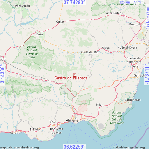
Castro de Filabres GPS coordinates[2]
37° 11' 5.424" North, 2° 26' 24.864" West
| Map corner | latitude | longitude |
|---|---|---|
| Upper-left | 37.74293°, | -3.14336° |
| Center: | 37.18484°, | -2.44024° |
| Lower-right: | 36.62259°, | -1.73711° |
| Map W x H: | 124.6×124.6 km | = 77.4×77.4mi |
| max Lat: | 43.74134° ⇑94.2% North |
| Castro de Filabres: | 37.18484° |
| min Lat: | ⇓5.8% South 27.64134° |
| min Long | Castro de Filab | max Long |
| -18.00367° | -2.44024° | 4.2899° |
| W 61.6%⇐ | ⇒38.4% E |
Elevation
Elevation of Castro de Filabres is 954 m = 3130 ft, and this is 356 m = 1168 ft above average elevation for this country.
| Max E: |
1682 m = 5518 ft | 14.7% |
| Castro de Filabres | 954 m 3130 ft | |
| Avg. | 598 m = 1962 ft | |
Min E: |
0 m = 0 ft | 85.3% |
See also: Spain elevation on elevation.city.
Geographical zone
Castro de Filabres is located in North temperate zone (between Tropic of Cancer and the Arctic Circle). Distance of this Northern Tropic circle is 1528.6 km =949.8 mi to South.| Distance of | km | miles | from Castro de Filabres |
|---|---|---|---|
| North Pole | 5872.5 | 3649 | to North |
| Arctic Circle | 3266.6 | 2029.8 | to North |
| Tropic Cancer | 1528.6 | 949.8 | to South |
| Equator | 4134.6 | 2569.1 | to South |


Nearby cities:
15 places around Castro de Filabres: (largest is in red/bold)
• Alcudia de Monteagud
16.4 km =10.2 mi,  69°
69°
• Bayarque
16.2 km =10.1 mi,  1°
1°
• Benitagla
18.5 km =11.5 mi, 73°
• Benizalón
17.8 km =11.1 mi,  80°
80°
• Chercos
17.2 km =10.7 mi,  63°
63°
• Gérgal
11.5 km =7.1 mi,  230°
230°
• La Mojonera
12 km =7.5 mi, 1°
• Laroya
15.7 km =9.8 mi,  36°
36°
• Olula de Castro
3.2 km =2 mi,  249°
249°
• Sierro
15.7 km =9.8 mi,  13°
13°
• Suflí
17.7 km =11 mi,  15°
15°
• Tabernas
15.6 km =9.7 mi,  163°
163°
• Tahal
14.6 km =9.1 mi, 70°
• Tíjola
17.9 km =11.1 mi, 1°
• Velefique
3.6 km =2.2 mi, 73°
Sources, notices
• [Note1] Compared only with cities in Spain existing in our database
• [Src1] Map data: © OpenStreetMap contributors (CC-BY-SA)
• [Src2] Other city data from geonames.org with taken over terms of usage.
• [Src3] Geographical zone / Annual Mean Temperature by Robert A. Rohde @ Wikipedia
