Rosal de la Frontera geodata
Rosal de la Frontera (Andalusia) is a seat of a third-order administrative division; located in Spain in Europe/Madrid (GMT+2) time zone. With population of 1,846 people, there are 2262 cities with bigger population in this country. Compared to other cities in Spain, 88.8% of cities are located further ↑North; 94.8% of cities are located further →East and 79.8% of cities have higher elevation than Rosal de la Frontera. Note1
Administrative division(s):
- Level 1: Andalusia
- Level 2: Provincia de Huelva
- Level 3: Rosal de la Frontera


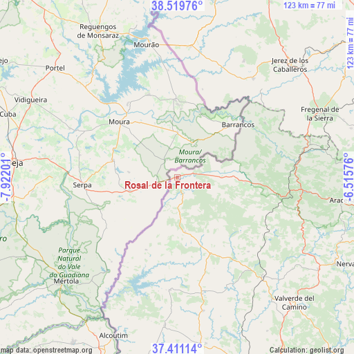
Rosal de la Frontera GPS coordinates[2]
37° 58' 3.144" North, 7° 13' 8.004" West
| Map corner | latitude | longitude |
|---|---|---|
| Upper-left | 38.51976°, | -7.92201° |
| Center: | 37.96754°, | -7.21889° |
| Lower-right: | 37.41114°, | -6.51576° |
| Map W x H: | 123.3×123.3 km | = 76.6×76.6mi |
| max Lat: | 43.74134° ⇑88.8% North |
| Rosal de la Frontera: | 37.96754° |
| min Lat: | ⇓11.2% South 27.64134° |
| min Long | Rosal de la Fro | max Long |
| -18.00367° | -7.21889° | 4.2899° |
| W 5.2%⇐ | ⇒94.8% E |
Elevation
Elevation of Rosal de la Frontera is 223 m = 732 ft, and this is 375 m = 1230 ft below average elevation for this country.
| Max E: |
1682 m = 5518 ft | 79.8% |
| Avg. | 598 m = 1962 ft | |
| Rosal de la Frontera | 223 m = 732 ft | |
Min E: |
0 m = 0 ft | 20.2% |
See also: Spain elevation on elevation.city.
Geographical zone
Rosal de la Frontera is located in North temperate zone (between Tropic of Cancer and the Arctic Circle). Distance of this Northern Tropic circle is 1615.7 km =1003.9 mi to South.| Distance of | km | miles | from Rosal de la Frontera |
|---|---|---|---|
| North Pole | 5785.5 | 3594.9 | to North |
| Arctic Circle | 3179.6 | 1975.7 | to North |
| Tropic Cancer | 1615.7 | 1003.9 | to South |
| Equator | 4221.6 | 2623.2 | to South |


Nearby cities:
15 places around Rosal de la Frontera: (largest is in red/bold)
• Aroche
23.1 km =14.4 mi,  97°
97°
• Cabezas Rubias
29.2 km =18.1 mi,  156°
156°
• Cortegana
35.5 km =22.1 mi, 100°
• El Cerro de Andévalo
35.8 km =22.2 mi,  136°
136°
• Encinasola
36 km =22.4 mi,  59°
59°
• Galaroza
45.1 km =28 mi, 95°
• Jabugo
43.3 km =26.9 mi, 97°
• Oliva de la Frontera
43.2 km =26.8 mi,  37°
37°
• Paymogo
27.6 km =17.1 mi,  203°
203°
• Puebla de Guzmán
39.4 km =24.5 mi,  183°
183°
• Santa Ana la Real
45 km =28 mi,  105°
105°
• Santa Bárbara de Casa
19.2 km =11.9 mi,  171°
171°
• Valencia del Mombuey
31.8 km =19.8 mi,  15°
15°
• Villanueva de las Cruces
41.5 km =25.8 mi, 155°
• Villanueva del Fresno
45.6 km =28.3 mi,  5°
5°
Sources, notices
• [Note1] Compared only with cities in Spain existing in our database
• [Src1] Map data: © OpenStreetMap contributors (CC-BY-SA)
• [Src2] Other city data from geonames.org with taken over terms of usage.
• [Src3] Geographical zone / Annual Mean Temperature by Robert A. Rohde @ Wikipedia
