Real de Montroi geodata
Real de Montroi (Valencia) is a seat of a third-order administrative division; located in Spain in Europe/Madrid (GMT+2) time zone. With population of 2,031 people, there are 2145 cities with bigger population in this country. Compared to other cities in Spain, 78.4% of cities are located further ↑North; 80.5% of cities are located further ←West and 86.2% of cities have higher elevation than Real de Montroi. Note1


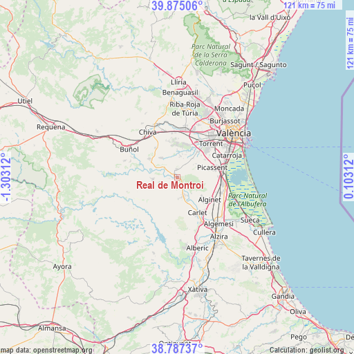
Real de Montroi GPS coordinates[2]
39° 19' 59.988" North, 0° 36' 0" West
| Map corner | latitude | longitude |
|---|---|---|
| Upper-left | 39.87506°, | -1.30312° |
| Center: | 39.33333°, | -0.6° |
| Lower-right: | 38.78737°, | 0.10312° |
| Map W x H: | 120.9×120.9 km | = 75.1×75.1mi |
| max Lat: | 43.74134° ⇑78.4% North |
| Real de Montroi: | 39.33333° |
| min Lat: | ⇓21.6% South 27.64134° |
| min Long | Real de Montroi | max Long |
| -18.00367° | -0.6° | 4.2899° |
| W 80.5%⇐ | ⇒19.5% E |
Elevation
Elevation of Real de Montroi is 119 m = 390 ft, and this is 479 m = 1572 ft below average elevation for this country.
| Max E: |
1682 m = 5518 ft | 86.2% |
| Avg. | 598 m = 1962 ft | |
| Real de Montroi | 119 m = 390 ft | |
Min E: |
0 m = 0 ft | 13.8% |
See also: Spain elevation on elevation.city.
Geographical zone
Real de Montroi is located in North temperate zone (between Tropic of Cancer and the Arctic Circle). Distance of this Northern Tropic circle is 1767.5 km =1098.3 mi to South.| Distance of | km | miles | from Real de Montroi |
|---|---|---|---|
| North Pole | 5633.6 | 3500.6 | to North |
| Arctic Circle | 3027.7 | 1881.3 | to North |
| Tropic Cancer | 1767.5 | 1098.3 | to South |
| Equator | 4373.5 | 2717.6 | to South |


Nearby cities:
15 places around Real de Montroi: (largest is in red/bold)
• Alborache
15.4 km =9.6 mi,  291°
291°
• Alcàsser
13.9 km =8.6 mi,  73°
73°
• Alfarp
7 km =4.3 mi,  142°
142°
• Alginet
13.7 km =8.5 mi,  122°
122°
• Benifaió
15.9 km =9.9 mi,  109°
109°
• Benimodo
14.7 km =9.1 mi,  154°
154°
• Carlet
13.7 km =8.5 mi, 150°
• Catadau
7.9 km =4.9 mi,  158°
158°
• Godelleta
11.7 km =7.3 mi,  322°
322°
• Llombai
6.3 km =3.9 mi, 152°
• Monserrat
3.7 km =2.3 mi,  0°
0°
• Montroy
1.4 km =0.9 mi,  270°
270°
• Picassent
12.5 km =7.8 mi, 74°
• Torrent
16.3 km =10.1 mi,  45°
45°
• Turís
10.2 km =6.3 mi,  302°
302°
Sources, notices
• [Note1] Compared only with cities in Spain existing in our database
• [Src1] Map data: © OpenStreetMap contributors (CC-BY-SA)
• [Src2] Other city data from geonames.org with taken over terms of usage.
• [Src3] Geographical zone / Annual Mean Temperature by Robert A. Rohde @ Wikipedia
