Alginet geodata
Alginet (Valencia) is a seat of a third-order administrative division; located in Spain in Europe/Madrid (GMT+2) time zone. With population of 13,226 people, there are 696 cities with bigger population in this country. Compared to other cities in Spain, 78.9% of cities are located further ↑North; 82% of cities are located further ←West and 93.6% of cities have higher elevation than Alginet. Note1


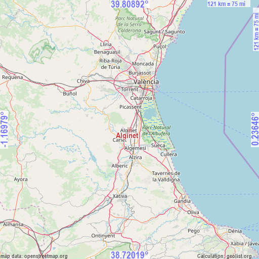
Alginet GPS coordinates[2]
39° 16' 0.012" North, 0° 28' 0.012" West
| Map corner | latitude | longitude |
|---|---|---|
| Upper-left | 39.80892°, | -1.16979° |
| Center: | 39.26667°, | -0.46667° |
| Lower-right: | 38.72019°, | 0.23646° |
| Map W x H: | 121.1×121.1 km | = 75.2×75.2mi |
| max Lat: | 43.74134° ⇑78.9% North |
| Alginet: | 39.26667° |
| min Lat: | ⇓21.1% South 27.64134° |
| min Long | Alginet | max Long |
| -18.00367° | -0.46667° | 4.2899° |
| W 82%⇐ | ⇒18% E |
Elevation
Elevation of Alginet is 34 m = 112 ft, and this is 564 m = 1850 ft below average elevation for this country.
| Max E: |
1682 m = 5518 ft | 93.6% |
| Avg. | 598 m = 1962 ft | |
| Alginet | 34 m = 112 ft | |
Min E: |
0 m = 0 ft | 6.4% |
See also: Spain elevation on elevation.city.
Geographical zone
Alginet is located in North temperate zone (between Tropic of Cancer and the Arctic Circle). Distance of this Northern Tropic circle is 1760.1 km =1093.7 mi to South.| Distance of | km | miles | from Alginet |
|---|---|---|---|
| North Pole | 5641 | 3505.2 | to North |
| Arctic Circle | 3035.1 | 1885.9 | to North |
| Tropic Cancer | 1760.1 | 1093.7 | to South |
| Equator | 4366 | 2712.9 | to South |


Nearby cities:
15 places around Alginet: (largest is in red/bold)
• Albalat de la Ribera
10.3 km =6.4 mi,  135°
135°
• Alcàsser
11.4 km =7.1 mi,  9°
9°
• Alfarp
7.4 km =4.6 mi,  284°
284°
• Algemesí
8.9 km =5.5 mi,  162°
162°
• Almussafes
4.7 km =2.9 mi,  66°
66°
• Benifaió
4 km =2.5 mi,  60°
60°
• Benimodo
7.8 km =4.8 mi,  221°
221°
• Carlet
6.5 km =4 mi,  226°
226°
• Catadau
8.6 km =5.3 mi,  270°
270°
• Guadassuar
9 km =5.6 mi,  186°
186°
• L'Alcúdia
8.4 km =5.2 mi,  203°
203°
• Llombai
8.8 km =5.5 mi, 282°
• Picassent
10.8 km =6.7 mi,  3°
3°
• Polinyà de Xúquer
11.4 km =7.1 mi,  130°
130°
• Sollana
7.4 km =4.6 mi,  79°
79°
Sources, notices
• [Note1] Compared only with cities in Spain existing in our database
• [Src1] Map data: © OpenStreetMap contributors (CC-BY-SA)
• [Src2] Other city data from geonames.org with taken over terms of usage.
• [Src3] Geographical zone / Annual Mean Temperature by Robert A. Rohde @ Wikipedia
