Carlet geodata
Carlet (Valencia) is a seat of a third-order administrative division; located in Spain in Europe/Madrid (GMT+2) time zone. With population of 15,527 people, there are 601 cities with bigger population in this country. Compared to other cities in Spain, 79.2% of cities are located further ↑North; 81.5% of cities are located further ←West and 90.7% of cities have higher elevation than Carlet. Note1


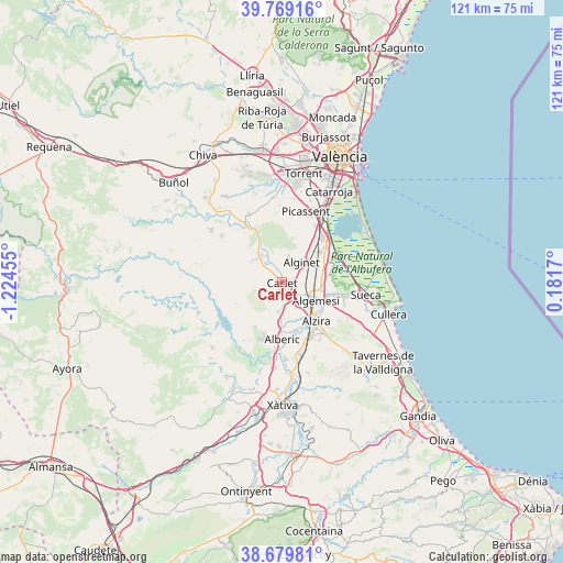
Carlet GPS coordinates[2]
39° 13' 35.76" North, 0° 31' 17.112" West
| Map corner | latitude | longitude |
|---|---|---|
| Upper-left | 39.76916°, | -1.22455° |
| Center: | 39.2266°, | -0.52142° |
| Lower-right: | 38.67981°, | 0.1817° |
| Map W x H: | 121.1×121.1 km | = 75.2×75.2mi |
| max Lat: | 43.74134° ⇑79.2% North |
| Carlet: | 39.2266° |
| min Lat: | ⇓20.8% South 27.64134° |
| min Long | Carlet | max Long |
| -18.00367° | -0.52142° | 4.2899° |
| W 81.5%⇐ | ⇒18.5% E |
Elevation
Elevation of Carlet is 55 m = 180 ft, and this is 543 m = 1781 ft below average elevation for this country.
| Max E: |
1682 m = 5518 ft | 90.7% |
| Avg. | 598 m = 1962 ft | |
| Carlet | 55 m = 180 ft | |
Min E: |
0 m = 0 ft | 9.3% |
See also: Spain elevation on elevation.city.
Geographical zone
Carlet is located in North temperate zone (between Tropic of Cancer and the Arctic Circle). Distance of this Northern Tropic circle is 1755.7 km =1090.9 mi to South.| Distance of | km | miles | from Carlet |
|---|---|---|---|
| North Pole | 5645.5 | 3507.9 | to North |
| Arctic Circle | 3039.6 | 1888.7 | to North |
| Tropic Cancer | 1755.7 | 1090.9 | to South |
| Equator | 4361.6 | 2710.2 | to South |


Nearby cities:
15 places around Carlet: (largest is in red/bold)
• Alberic
12.2 km =7.6 mi,  178°
178°
• Alfarp
6.8 km =4.2 mi,  338°
338°
• Algemesí
8.4 km =5.2 mi,  118°
118°
• Alginet
6.5 km =4 mi,  46°
46°
• Almussafes
11 km =6.8 mi,  55°
55°
• Alzira
11.4 km =7.1 mi,  138°
138°
• Benifaió
10.4 km =6.5 mi, 51°
• Benimodo
1.5 km =0.9 mi,  198°
198°
• Benimuslem
10.8 km =6.7 mi,  166°
166°
• Catadau
5.9 km =3.7 mi,  318°
318°
• Guadassuar
5.8 km =3.6 mi, 140°
• L'Alcúdia
3.6 km =2.2 mi,  157°
157°
• Llombai
7.4 km =4.6 mi,  328°
328°
• Masalavés
9.2 km =5.7 mi, 180°
• Tous
11.2 km =7 mi,  210°
210°
Sources, notices
• [Note1] Compared only with cities in Spain existing in our database
• [Src1] Map data: © OpenStreetMap contributors (CC-BY-SA)
• [Src2] Other city data from geonames.org with taken over terms of usage.
• [Src3] Geographical zone / Annual Mean Temperature by Robert A. Rohde @ Wikipedia
