Montroy geodata
Montroy (Valencia) is a seat of a third-order administrative division; located in Spain in Europe/Madrid (GMT+2) time zone. With population of 1,768 people, there are 2307 cities with bigger population in this country. Compared to other cities in Spain, 78.4% of cities are located further ↑North; 80.4% of cities are located further ←West and 85.2% of cities have higher elevation than Montroy. Note1


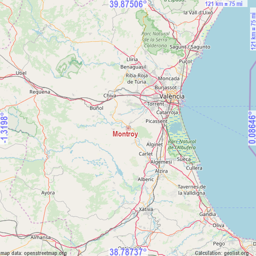
Montroy GPS coordinates[2]
39° 19' 59.988" North, 0° 37' 0.012" West
| Map corner | latitude | longitude |
|---|---|---|
| Upper-left | 39.87506°, | -1.3198° |
| Center: | 39.33333°, | -0.61667° |
| Lower-right: | 38.78737°, | 0.08646° |
| Map W x H: | 120.9×120.9 km | = 75.1×75.1mi |
| max Lat: | 43.74134° ⇑78.4% North |
| Montroy: | 39.33333° |
| min Lat: | ⇓21.6% South 27.64134° |
| min Long | Montroy | max Long |
| -18.00367° | -0.61667° | 4.2899° |
| W 80.4%⇐ | ⇒19.6% E |
Elevation
Elevation of Montroy is 135 m = 443 ft, and this is 463 m = 1519 ft below average elevation for this country.
| Max E: |
1682 m = 5518 ft | 85.2% |
| Avg. | 598 m = 1962 ft | |
| Montroy | 135 m = 443 ft | |
Min E: |
0 m = 0 ft | 14.8% |
See also: Spain elevation on elevation.city.
Geographical zone
Montroy is located in North temperate zone (between Tropic of Cancer and the Arctic Circle). Distance of this Northern Tropic circle is 1767.5 km =1098.3 mi to South.| Distance of | km | miles | from Montroy |
|---|---|---|---|
| North Pole | 5633.6 | 3500.6 | to North |
| Arctic Circle | 3027.7 | 1881.3 | to North |
| Tropic Cancer | 1767.5 | 1098.3 | to South |
| Equator | 4373.5 | 2717.6 | to South |


Nearby cities:
15 places around Montroy: (largest is in red/bold)
• Alborache
14 km =8.7 mi,  293°
293°
• Alcàsser
15.3 km =9.5 mi,  75°
75°
• Alfarp
8 km =5 mi,  134°
134°
• Alginet
14.9 km =9.3 mi,  119°
119°
• Benimodo
15.4 km =9.6 mi,  149°
149°
• Carlet
14.4 km =8.9 mi, 145°
• Catadau
8.6 km =5.3 mi, 149°
• Godelleta
10.9 km =6.8 mi,  328°
328°
• Llombai
7 km =4.3 mi,  142°
142°
• Macastre
15.4 km =9.6 mi, 291°
• Millares
15.9 km =9.9 mi,  234°
234°
• Monserrat
4 km =2.5 mi,  21°
21°
• Picassent
13.9 km =8.6 mi, 76°
• Real de Montroi
1.4 km =0.9 mi,  90°
90°
• Turís
9.1 km =5.7 mi,  307°
307°
Sources, notices
• [Note1] Compared only with cities in Spain existing in our database
• [Src1] Map data: © OpenStreetMap contributors (CC-BY-SA)
• [Src2] Other city data from geonames.org with taken over terms of usage.
• [Src3] Geographical zone / Annual Mean Temperature by Robert A. Rohde @ Wikipedia
