Castillejo de Iniesta geodata
Castillejo de Iniesta (Castille-La Mancha) is a seat of a third-order administrative division; located in Spain in Europe/Madrid (GMT+2) time zone. With population of 194 people, there are 5078 cities with bigger population in this country. Compared to other cities in Spain, 76.6% of cities are located further ↑North; 69.8% of cities are located further ←West and 70.4% of cities have lower elevation than Castillejo de Iniesta. Note1
Administrative division(s):
- Level 1: Castille-La Mancha
- Level 2: Provincia de Cuenca
- Level 3: Castillejo de Iniesta
Current local time in Castillejo de Iniesta:
11:55 PM, ThursdayDifference from your time zone: hours


Castillejo de Iniesta GPS coordinates[2]
39° 31' 59.988" North, 1° 46' 0.012" West
| Map corner | latitude | longitude |
|---|---|---|
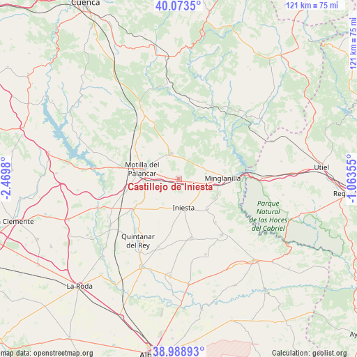
| Upper-left | 40.0735°, | -2.4698° |
| Center: | 39.53333°, | -1.76667° |
| Lower-right: | 38.98893°, | -1.06355° |
| Map W x H: | 120.6×120.6 km | = 74.9×74.9mi |
| max Lat: | 43.74134° ⇑76.6% North |
| Castillejo de Iniesta: | 39.53333° |
| min Lat: | ⇓23.4% South 27.64134° |
| min Long | Castillejo de I | max Long |
| -18.00367° | -1.76667° | 4.2899° |
| W 69.8%⇐ | ⇒30.2% E |
Elevation
Elevation of Castillejo de Iniesta is 817 m = 2680 ft, and this is 219 m = 719 ft above average elevation for this country.
| Max E: |
1682 m = 5518 ft | 29.6% |
| Castillejo de Iniesta | 817 m 2680 ft | |
| Avg. | 598 m = 1962 ft | |
Min E: |
0 m = 0 ft | 70.4% |
See also: Spain elevation on elevation.city.
Geographical zone
Castillejo de Iniesta is located in North temperate zone (between Tropic of Cancer and the Arctic Circle). Distance of this Northern Tropic circle is 1789.8 km =1112.1 mi to South.| Distance of | km | miles | from Castillejo de Iniesta |
|---|---|---|---|
| North Pole | 5611.4 | 3486.8 | to North |
| Arctic Circle | 3005.5 | 1867.5 | to North |
| Tropic Cancer | 1789.8 | 1112.1 | to South |
| Equator | 4395.7 | 2731.4 | to South |


Nearby cities:
15 places around Castillejo de Iniesta: (largest is in red/bold)
• Campillo de Altobuey
7.9 km =4.9 mi,  338°
338°
• El Herrumblar
19.6 km =12.2 mi,  139°
139°
• El Peral
12 km =7.5 mi,  252°
252°
• Enguídanos
20.6 km =12.8 mi,  43°
43°
• Gabaldón
17 km =10.6 mi,  302°
302°
• Graja de Iniesta
8.8 km =5.5 mi,  102°
102°
• Iniesta
11.2 km =7 mi,  172°
172°
• Ledaña
19.4 km =12.1 mi,  162°
162°
• Minglanilla
14.3 km =8.9 mi,  90°
90°
• Motilla del Palancar
10.7 km =6.6 mi,  290°
290°
• Paracuellos
20.4 km =12.7 mi,  355°
355°
• Puebla del Salvador
9.3 km =5.8 mi,  66°
66°
• Villalpardo
13.6 km =8.5 mi,  122°
122°
• Villanueva de la Jara
18.1 km =11.2 mi,  232°
232°
• Villarta
13.6 km =8.5 mi,  132°
132°
Sources, notices
• [Note1] Compared only with cities in Spain existing in our database
• [Src1] Map data: © OpenStreetMap contributors (CC-BY-SA)
• [Src2] Other city data from geonames.org with taken over terms of usage.
• [Src3] Geographical zone / Annual Mean Temperature by Robert A. Rohde @ Wikipedia
