Moclín geodata
Moclín (Andalusia) is a seat of a third-order administrative division; located in Spain in Europe/Madrid (GMT+2) time zone. With population of 4,173 people, there are 1441 cities with bigger population in this country. Compared to other cities in Spain, 92.6% of cities are located further ↑North; 56.6% of cities are located further →East and 89% of cities have lower elevation than Moclín. Note1


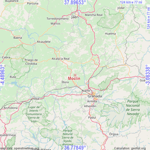
Moclín GPS coordinates[2]
37° 20' 22.524" North, 3° 47' 11.436" West
| Map corner | latitude | longitude |
|---|---|---|
| Upper-left | 37.89653°, | -4.48963° |
| Center: | 37.33959°, | -3.78651° |
| Lower-right: | 36.77849°, | -3.08338° |
| Map W x H: | 124.3×124.3 km | = 77.2×77.2mi |
| max Lat: | 43.74134° ⇑92.6% North |
| Moclín: | 37.33959° |
| min Lat: | ⇓7.4% South 27.64134° |
| min Long | Moclín | max Long |
| -18.00367° | -3.78651° | 4.2899° |
| W 43.4%⇐ | ⇒56.6% E |
Elevation
Elevation of Moclín is 1014 m = 3327 ft, and this is 416 m = 1365 ft above average elevation for this country.
| Max E: |
1682 m = 5518 ft | 11% |
| Moclín | 1014 m 3327 ft | |
| Avg. | 598 m = 1962 ft | |
Min E: |
0 m = 0 ft | 89% |
See also: Spain elevation on elevation.city.
Geographical zone
Moclín is located in North temperate zone (between Tropic of Cancer and the Arctic Circle). Distance of this Northern Tropic circle is 1545.9 km =960.6 mi to South.| Distance of | km | miles | from Moclín |
|---|---|---|---|
| North Pole | 5855.3 | 3638.3 | to North |
| Arctic Circle | 3249.4 | 2019.1 | to North |
| Tropic Cancer | 1545.9 | 960.6 | to South |
| Equator | 4151.8 | 2579.8 | to South |


Nearby cities:
15 places around Moclín: (largest is in red/bold)
• Albolote
16.8 km =10.4 mi,  136°
136°
• Atarfe
15.5 km =9.6 mi,  145°
145°
• Benalúa de las Villas
13.4 km =8.3 mi,  42°
42°
• Calicasas
17.1 km =10.6 mi,  116°
116°
• Chauchina
15.6 km =9.7 mi,  175°
175°
• Cijuela
15.9 km =9.9 mi,  188°
188°
• Colomera
7.3 km =4.5 mi,  61°
61°
• Deifontes
16.9 km =10.5 mi,  95°
95°
• Frailes
16.9 km =10.5 mi,  344°
344°
• Fuente Vaqueros
13.3 km =8.3 mi, 178°
• Illora
10.2 km =6.3 mi,  235°
235°
• Láchar
16.6 km =10.3 mi, 194°
• Pinos Puente
10.4 km =6.5 mi,  161°
161°
• Santafé
17.8 km =11.1 mi, 160°
• Valderrubio
12.1 km =7.5 mi, 194°
Sources, notices
• [Note1] Compared only with cities in Spain existing in our database
• [Src1] Map data: © OpenStreetMap contributors (CC-BY-SA)
• [Src2] Other city data from geonames.org with taken over terms of usage.
• [Src3] Geographical zone / Annual Mean Temperature by Robert A. Rohde @ Wikipedia
