Illora geodata
Illora (Andalusia) is a seat of a third-order administrative division; located in Spain in Europe/Madrid (GMT+2) time zone. With population of 10,440 people, there are 828 cities with bigger population in this country. Compared to other cities in Spain, 93.1% of cities are located further ↑North; 58% of cities are located further →East and 62.9% of cities have lower elevation than Illora. Note1


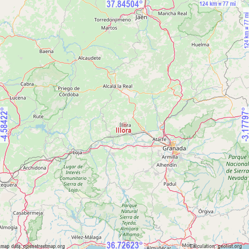
Illora GPS coordinates[2]
37° 17' 15.756" North, 3° 52' 51.924" West
| Map corner | latitude | longitude |
|---|---|---|
| Upper-left | 37.84504°, | -4.58422° |
| Center: | 37.28771°, | -3.88109° |
| Lower-right: | 36.72623°, | -3.17797° |
| Map W x H: | 124.4×124.4 km | = 77.3×77.3mi |
| max Lat: | 43.74134° ⇑93.1% North |
| Illora: | 37.28771° |
| min Lat: | ⇓6.9% South 27.64134° |
| min Long | Illora | max Long |
| -18.00367° | -3.88109° | 4.2899° |
| W 42%⇐ | ⇒58% E |
Elevation
Elevation of Illora is 764 m = 2507 ft, and this is 166 m = 545 ft above average elevation for this country.
| Max E: |
1682 m = 5518 ft | 37.1% |
| Illora | 764 m 2507 ft | |
| Avg. | 598 m = 1962 ft | |
Min E: |
0 m = 0 ft | 62.9% |
See also: Spain elevation on elevation.city.
Geographical zone
Illora is located in North temperate zone (between Tropic of Cancer and the Arctic Circle). Distance of this Northern Tropic circle is 1540.1 km =957 mi to South.| Distance of | km | miles | from Illora |
|---|---|---|---|
| North Pole | 5861.1 | 3641.9 | to North |
| Arctic Circle | 3255.2 | 2022.7 | to North |
| Tropic Cancer | 1540.1 | 957 | to South |
| Equator | 4146 | 2576.2 | to South |


Nearby cities:
15 places around Illora: (largest is in red/bold)
• Chauchina
13.8 km =8.6 mi,  135°
135°
• Chimeneas
18.2 km =11.3 mi,  163°
163°
• Cijuela
11.7 km =7.3 mi,  148°
148°
• Colomera
17.5 km =10.9 mi,  57°
57°
• Fuente Vaqueros
11.5 km =7.1 mi,  130°
130°
• Huétor-Tájar
17.7 km =11 mi,  235°
235°
• Láchar
11.1 km =6.9 mi, 157°
• Moclín
10.2 km =6.3 mi, 55°
• Montefrío
12 km =7.5 mi,  289°
289°
• Moraleda de Zafayona
15.3 km =9.5 mi,  209°
209°
• Pinos Puente
12.3 km =7.6 mi,  109°
109°
• Santafé
18.1 km =11.2 mi, 127°
• Valderrubio
8.1 km =5 mi, 137°
• Venta Nueva
17.9 km =11.1 mi,  230°
230°
• Villanueva de Mesía
14.3 km =8.9 mi, 235°
Sources, notices
• [Note1] Compared only with cities in Spain existing in our database
• [Src1] Map data: © OpenStreetMap contributors (CC-BY-SA)
• [Src2] Other city data from geonames.org with taken over terms of usage.
• [Src3] Geographical zone / Annual Mean Temperature by Robert A. Rohde @ Wikipedia
