Pinos Puente geodata
Pinos Puente (Andalusia) is a seat of a third-order administrative division; located in Spain in Europe/Madrid (GMT+2) time zone. With population of 13,515 people, there are 683 cities with bigger population in this country. Compared to other cities in Spain, 93.5% of cities are located further ↑North; 56% of cities are located further →East and 56.5% of cities have higher elevation than Pinos Puente. Note1


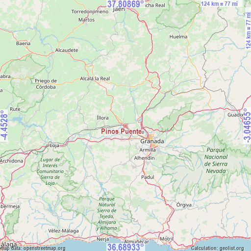
Pinos Puente GPS coordinates[2]
37° 15' 3.924" North, 3° 44' 58.812" West
| Map corner | latitude | longitude |
|---|---|---|
| Upper-left | 37.80869°, | -4.4528° |
| Center: | 37.25109°, | -3.74967° |
| Lower-right: | 36.68933°, | -3.04655° |
| Map W x H: | 124.5×124.5 km | = 77.4×77.4mi |
| max Lat: | 43.74134° ⇑93.5% North |
| Pinos Puente: | 37.25109° |
| min Lat: | ⇓6.5% South 27.64134° |
| min Long | Pinos Puente | max Long |
| -18.00367° | -3.74967° | 4.2899° |
| W 44%⇐ | ⇒56% E |
Elevation
Elevation of Pinos Puente is 573 m = 1880 ft, and this is 25 m = 82 ft below average elevation for this country.
| Max E: |
1682 m = 5518 ft | 56.5% |
| Avg. | 598 m = 1962 ft | |
| Pinos Puente | 573 m = 1880 ft | |
Min E: |
0 m = 0 ft | 43.5% |
See also: Spain elevation on elevation.city.
Geographical zone
Pinos Puente is located in North temperate zone (between Tropic of Cancer and the Arctic Circle). Distance of this Northern Tropic circle is 1536 km =954.4 mi to South.| Distance of | km | miles | from Pinos Puente |
|---|---|---|---|
| North Pole | 5865.1 | 3644.4 | to North |
| Arctic Circle | 3259.2 | 2025.2 | to North |
| Tropic Cancer | 1536 | 954.4 | to South |
| Equator | 4141.9 | 2573.7 | to South |


Nearby cities:
15 places around Pinos Puente: (largest is in red/bold)
• Albolote
8.7 km =5.4 mi,  105°
105°
• Atarfe
6.3 km =3.9 mi,  117°
117°
• Calicasas
12.3 km =7.6 mi,  79°
79°
• Chauchina
6 km =3.7 mi,  198°
198°
• Cijuela
8.1 km =5 mi,  222°
222°
• Cúllar-Vega
12.9 km =8 mi,  147°
147°
• Fuente Vaqueros
4.5 km =2.8 mi, 220°
• Illora
12.3 km =7.6 mi,  289°
289°
• Láchar
9.6 km =6 mi,  229°
229°
• Maracena
11.2 km =7 mi, 115°
• Moclín
10.4 km =6.5 mi,  341°
341°
• Peligros
10.9 km =6.8 mi,  101°
101°
• Pulianas
12.9 km =8 mi, 104°
• Santafé
7.5 km =4.7 mi,  158°
158°
• Valderrubio
6.5 km =4 mi,  252°
252°
Sources, notices
• [Note1] Compared only with cities in Spain existing in our database
• [Src1] Map data: © OpenStreetMap contributors (CC-BY-SA)
• [Src2] Other city data from geonames.org with taken over terms of usage.
• [Src3] Geographical zone / Annual Mean Temperature by Robert A. Rohde @ Wikipedia
