Maspalomas geodata
Maspalomas (Canary Islands) is a populated place; located in Spain in Atlantic/Canary (GMT+1) time zone. With population of 33,000 people, there are 272 cities with bigger population in this country. Compared to other cities in Spain, 100% of cities are located further ↑North; 99% of cities are located further →East and 93.9% of cities have higher elevation than Maspalomas. Note1
Administrative division(s):
- Level 1: Canary Islands
- Level 2: Provincia de Las Palmas
- Level 3: San Bartolomé de Tirajana


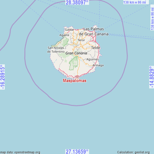
Maspalomas GPS coordinates[2]
27° 45' 38.016" North, 15° 35' 9.672" West
| Map corner | latitude | longitude |
|---|---|---|
| Upper-left | 28.38097°, | -16.28915° |
| Center: | 27.76056°, | -15.58602° |
| Lower-right: | 27.13659°, | -14.8829° |
| Map W x H: | 138.4×138.4 km | = 86×86mi |
| max Lat: | 43.74134° ⇑100% North |
| Maspalomas: | 27.76056° |
| min Lat: | ⇓0% South 27.64134° |
| min Long | Maspalomas | max Long |
| -18.00367° | -15.58602° | 4.2899° |
| W 1%⇐ | ⇒99% E |
Elevation
Elevation of Maspalomas is 32 m = 105 ft, and this is 566 m = 1857 ft below average elevation for this country.
| Max E: |
1682 m = 5518 ft | 93.9% |
| Avg. | 598 m = 1962 ft | |
| Maspalomas | 32 m = 105 ft | |
Min E: |
0 m = 0 ft | 6.1% |
See also: Spain elevation on elevation.city.
Geographical zone
Maspalomas is located in North temperate zone (between Tropic of Cancer and the Arctic Circle). Distance of this Northern Tropic circle is 480.8 km =298.8 mi to South.| Distance of | km | miles | from Maspalomas |
|---|---|---|---|
| North Pole | 6920.4 | 4300.1 | to North |
| Arctic Circle | 4314.5 | 2680.9 | to North |
| Tropic Cancer | 480.8 | 298.8 | to South |
| Equator | 3086.7 | 1918 | to South |


Nearby cities:
15 places around Maspalomas: (largest is in red/bold)
• Agüimes
21.2 km =13.2 mi,  40°
40°
• Artenara
29.5 km =18.3 mi,  348°
348°
• Carrizal
24.4 km =15.2 mi,  46°
46°
• Cruce de Arinaga
20.2 km =12.6 mi, 50°
• Ingenio
23 km =14.3 mi, 40°
• Mogán
19.4 km =12.1 mi,  315°
315°
• Playa del Ingles
0.8 km =0.5 mi,  120°
120°
• Puerto Rico
12.7 km =7.9 mi,  284°
284°
• San Bartolomé de Tirajana
18.3 km =11.4 mi,  3°
3°
• Santa Lucía
17.4 km =10.8 mi,  14°
14°
• Tejeda
26.2 km =16.3 mi, 353°
• Telde
30.6 km =19 mi,  32°
32°
• Valsequillo de Gran Canaria
26.5 km =16.5 mi,  19°
19°
• Vecindario
16.9 km =10.5 mi,  55°
55°
• Vega de San Mateo
28.1 km =17.5 mi, 10°
Sources, notices
• [Note1] Compared only with cities in Spain existing in our database
• [Src1] Map data: © OpenStreetMap contributors (CC-BY-SA)
• [Src2] Other city data from geonames.org with taken over terms of usage.
• [Src3] Geographical zone / Annual Mean Temperature by Robert A. Rohde @ Wikipedia
