Masegoso geodata
Masegoso (Castille-La Mancha) is a seat of a third-order administrative division; located in Spain in Europe/Madrid (GMT+2) time zone. With population of 127 people, there are 5616 cities with bigger population in this country. Compared to other cities in Spain, 84.1% of cities are located further ↑North; 63.2% of cities are located further ←West and 93.6% of cities have lower elevation than Masegoso. Note1
Administrative division(s):
- Level 1: Castille-La Mancha
- Level 2: Provincia de Albacete
- Level 3: Masegoso


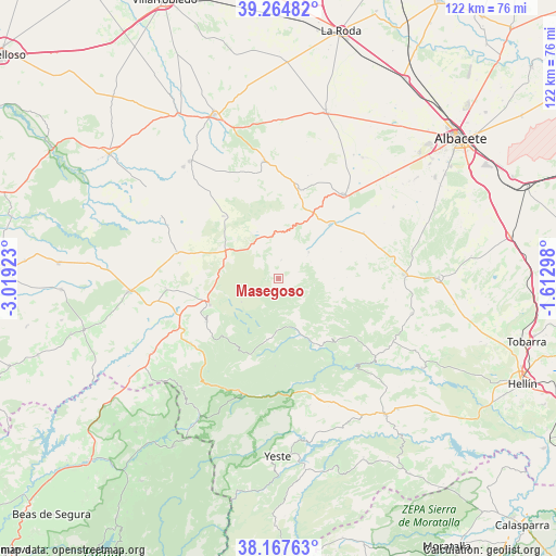
Masegoso GPS coordinates[2]
38° 43' 5.988" North, 2° 18' 57.96" West
| Map corner | latitude | longitude |
|---|---|---|
| Upper-left | 39.26482°, | -3.01923° |
| Center: | 38.71833°, | -2.3161° |
| Lower-right: | 38.16763°, | -1.61298° |
| Map W x H: | 122×122 km | = 75.8×75.8mi |
| max Lat: | 43.74134° ⇑84.1% North |
| Masegoso: | 38.71833° |
| min Lat: | ⇓15.9% South 27.64134° |
| min Long | Masegoso | max Long |
| -18.00367° | -2.3161° | 4.2899° |
| W 63.2%⇐ | ⇒36.8% E |
Elevation
Elevation of Masegoso is 1107 m = 3632 ft, and this is 509 m = 1670 ft above average elevation for this country.
| Max E: |
1682 m = 5518 ft | 6.4% |
| Masegoso | 1107 m 3632 ft | |
| Avg. | 598 m = 1962 ft | |
Min E: |
0 m = 0 ft | 93.6% |
See also: Spain elevation on elevation.city.
Geographical zone
Masegoso is located in North temperate zone (between Tropic of Cancer and the Arctic Circle). Distance of this Northern Tropic circle is 1699.2 km =1055.8 mi to South.| Distance of | km | miles | from Masegoso |
|---|---|---|---|
| North Pole | 5702 | 3543.1 | to North |
| Arctic Circle | 3096.1 | 1923.8 | to North |
| Tropic Cancer | 1699.2 | 1055.8 | to South |
| Equator | 4305.1 | 2675.1 | to South |


Nearby cities:
15 places around Masegoso: (largest is in red/bold)
• Alcaraz
16.2 km =10.1 mi,  249°
249°
• Balazote
23.3 km =14.5 mi,  37°
37°
• Bogarra
17.7 km =11 mi,  149°
149°
• Casas de Lázaro
8.8 km =5.5 mi,  48°
48°
• El Ballestero
18.3 km =11.4 mi,  318°
318°
• Lezuza
25.9 km =16.1 mi,  352°
352°
• Paterna del Madera
13.7 km =8.5 mi,  190°
190°
• Peñas de San Pedro
27 km =16.8 mi,  87°
87°
• Povedilla
24.9 km =15.5 mi,  265°
265°
• Pozuelo
21.2 km =13.2 mi,  61°
61°
• Riópar
26.9 km =16.7 mi,  205°
205°
• Robledo
12.5 km =7.8 mi,  290°
290°
• Salobre
24.7 km =15.3 mi,  235°
235°
• San Pedro
16.6 km =10.3 mi, 44°
• Viveros
23.2 km =14.4 mi, 285°
Sources, notices
• [Note1] Compared only with cities in Spain existing in our database
• [Src1] Map data: © OpenStreetMap contributors (CC-BY-SA)
• [Src2] Other city data from geonames.org with taken over terms of usage.
• [Src3] Geographical zone / Annual Mean Temperature by Robert A. Rohde @ Wikipedia
