Lucillos geodata
Lucillos (Castille-La Mancha) is a seat of a third-order administrative division; located in Spain in Europe/Madrid (GMT+2) time zone. With population of 483 people, there are 3929 cities with bigger population in this country. Compared to other cities in Spain, 70.4% of cities are located further ↑North; 67.4% of cities are located further →East and 63.5% of cities have higher elevation than Lucillos. Note1
Administrative division(s):
- Level 1: Castille-La Mancha
- Level 2: Province of Toledo
- Level 3: Lucillos


Lucillos GPS coordinates[2]
39° 59' 6.36" North, 4° 36' 46.044" West
| Map corner | latitude | longitude |
|---|---|---|
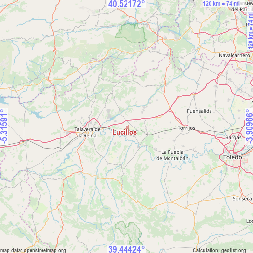
| Upper-left | 40.52172°, | -5.31591° |
| Center: | 39.9851°, | -4.61279° |
| Lower-right: | 39.44424°, | -3.90966° |
| Map W x H: | 119.8×119.8 km | = 74.4×74.4mi |
| max Lat: | 43.74134° ⇑70.4% North |
| Lucillos: | 39.9851° |
| min Lat: | ⇓29.6% South 27.64134° |
| min Long | Lucillos | max Long |
| -18.00367° | -4.61279° | 4.2899° |
| W 32.6%⇐ | ⇒67.4% E |
Elevation
Elevation of Lucillos is 481 m = 1578 ft, and this is 117 m = 384 ft below average elevation for this country.
| Max E: |
1682 m = 5518 ft | 63.5% |
| Avg. | 598 m = 1962 ft | |
| Lucillos | 481 m = 1578 ft | |
Min E: |
0 m = 0 ft | 36.5% |
See also: Spain elevation on elevation.city.
Geographical zone
Lucillos is located in North temperate zone (between Tropic of Cancer and the Arctic Circle). Distance of this Northern Tropic circle is 1840 km =1143.3 mi to South.| Distance of | km | miles | from Lucillos |
|---|---|---|---|
| North Pole | 5561.1 | 3455.5 | to North |
| Arctic Circle | 2955.2 | 1836.3 | to North |
| Tropic Cancer | 1840 | 1143.3 | to South |
| Equator | 4445.9 | 2762.6 | to South |


Nearby cities:
15 places around Lucillos: (largest is in red/bold)
• Cardiel de los Montes
9.4 km =5.8 mi,  337°
337°
• Carriches
13.3 km =8.3 mi,  100°
100°
• Castillo de Bayuela
14.2 km =8.8 mi,  334°
334°
• Cazalegas
6 km =3.7 mi,  296°
296°
• Cebolla
5.3 km =3.3 mi,  138°
138°
• Domingo Pérez
9.2 km =5.7 mi, 95°
• El Casar de Escalona
10.1 km =6.3 mi,  47°
47°
• Erustes
10.4 km =6.5 mi,  107°
107°
• Illán de Vacas
5 km =3.1 mi, 108°
• La Mata
15.7 km =9.8 mi, 108°
• La Pueblanueva
9.9 km =6.2 mi,  214°
214°
• Malpica
11.1 km =6.9 mi,  151°
151°
• Montearagón
2.8 km =1.7 mi,  215°
215°
• Nuño Gómez
14.3 km =8.9 mi,  357°
357°
• Otero
8.5 km =5.3 mi,  78°
78°
Sources, notices
• [Note1] Compared only with cities in Spain existing in our database
• [Src1] Map data: © OpenStreetMap contributors (CC-BY-SA)
• [Src2] Other city data from geonames.org with taken over terms of usage.
• [Src3] Geographical zone / Annual Mean Temperature by Robert A. Rohde @ Wikipedia
