La Mata geodata
La Mata (Castille-La Mancha) is a populated place; located in Spain in Europe/Madrid (GMT+2) time zone. With population of 947 people, there are 3017 cities with bigger population in this country. Compared to other cities in Spain, 71.1% of cities are located further ↑North; 65.4% of cities are located further →East and 57.1% of cities have higher elevation than La Mata. Note1
Administrative division(s):
- Level 1: Castille-La Mancha
- Level 2: Province of Toledo
- Level 3: Mata, La


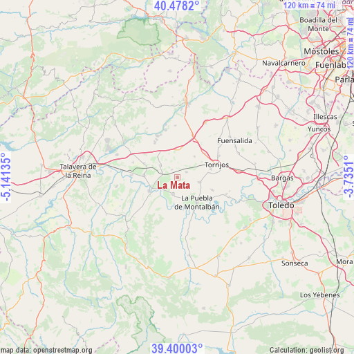
La Mata GPS coordinates[2]
39° 56' 28.464" North, 4° 26' 17.592" West
| Map corner | latitude | longitude |
|---|---|---|
| Upper-left | 40.4782°, | -5.14135° |
| Center: | 39.94124°, | -4.43822° |
| Lower-right: | 39.40003°, | -3.7351° |
| Map W x H: | 119.9×119.9 km | = 74.5×74.5mi |
| max Lat: | 43.74134° ⇑71.1% North |
| La Mata: | 39.94124° |
| min Lat: | ⇓28.9% South 27.64134° |
| min Long | La Mata | max Long |
| -18.00367° | -4.43822° | 4.2899° |
| W 34.6%⇐ | ⇒65.4% E |
Elevation
Elevation of La Mata is 564 m = 1850 ft, and this is 34 m = 112 ft below average elevation for this country.
| Max E: |
1682 m = 5518 ft | 57.1% |
| Avg. | 598 m = 1962 ft | |
| La Mata | 564 m = 1850 ft | |
Min E: |
0 m = 0 ft | 42.9% |
See also: Spain elevation on elevation.city.
Geographical zone
La Mata is located in North temperate zone (between Tropic of Cancer and the Arctic Circle). Distance of this Northern Tropic circle is 1835.1 km =1140.3 mi to South.| Distance of | km | miles | from La Mata |
|---|---|---|---|
| North Pole | 5566 | 3458.6 | to North |
| Arctic Circle | 2960.1 | 1839.3 | to North |
| Tropic Cancer | 1835.1 | 1140.3 | to South |
| Equator | 4441 | 2759.5 | to South |


Nearby cities:
15 places around La Mata: (largest is in red/bold)
• Alcabón
9 km =5.6 mi,  41°
41°
• Burujón
12.8 km =8 mi,  110°
110°
• Carmena
3.5 km =2.2 mi,  62°
62°
• Carriches
3.1 km =1.9 mi,  325°
325°
• Cebolla
11.4 km =7.1 mi,  274°
274°
• Domingo Pérez
7 km =4.3 mi,  304°
304°
• El Carpio de Tajo
6.1 km =3.8 mi,  192°
192°
• Erustes
5.3 km =3.3 mi,  289°
289°
• Escalonilla
7.6 km =4.7 mi,  103°
103°
• Gerindote
11.9 km =7.4 mi,  76°
76°
• Illán de Vacas
10.7 km =6.6 mi, 287°
• La Puebla de Montalbán
11 km =6.8 mi,  142°
142°
• Malpica
10.7 km =6.6 mi,  242°
242°
• Otero
9.3 km =5.8 mi,  315°
315°
• Santa Olalla
9.2 km =5.7 mi,  4°
4°
Sources, notices
• [Note1] Compared only with cities in Spain existing in our database
• [Src1] Map data: © OpenStreetMap contributors (CC-BY-SA)
• [Src2] Other city data from geonames.org with taken over terms of usage.
• [Src3] Geographical zone / Annual Mean Temperature by Robert A. Rohde @ Wikipedia
