Burujón geodata
Burujón (Castille-La Mancha) is a seat of a third-order administrative division; located in Spain in Europe/Madrid (GMT+2) time zone. With population of 1,449 people, there are 2515 cities with bigger population in this country. Compared to other cities in Spain, 71.5% of cities are located further ↑North; 63.8% of cities are located further →East and 61.9% of cities have higher elevation than Burujón. Note1
Administrative division(s):
- Level 1: Castille-La Mancha
- Level 2: Province of Toledo
- Level 3: Burujón


Burujón GPS coordinates[2]
39° 54' 4.068" North, 4° 17' 50.28" West
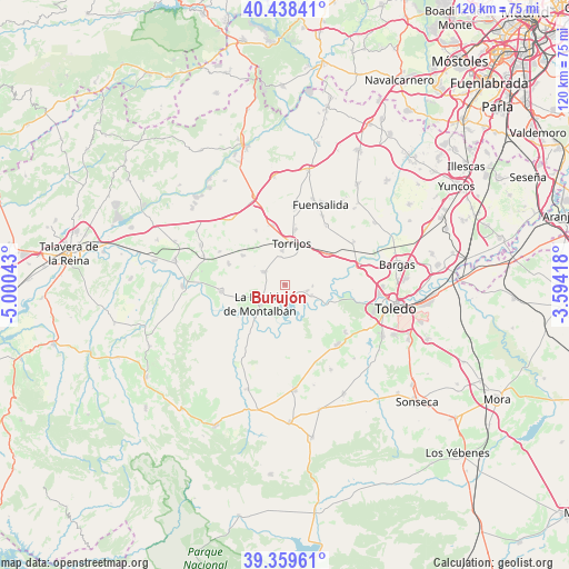
| Map corner | latitude | longitude |
|---|---|---|
| Upper-left | 40.43841°, | -5.00043° |
| Center: | 39.90113°, | -4.2973° |
| Lower-right: | 39.35961°, | -3.59418° |
| Map W x H: | 120×120 km | = 74.6×74.6mi |
| max Lat: | 43.74134° ⇑71.5% North |
| Burujón: | 39.90113° |
| min Lat: | ⇓28.5% South 27.64134° |
| min Long | Burujón | max Long |
| -18.00367° | -4.2973° | 4.2899° |
| W 36.2%⇐ | ⇒63.8% E |
Elevation
Elevation of Burujón is 500 m = 1640 ft, and this is 98 m = 322 ft below average elevation for this country.
| Max E: |
1682 m = 5518 ft | 61.9% |
| Avg. | 598 m = 1962 ft | |
| Burujón | 500 m = 1640 ft | |
Min E: |
0 m = 0 ft | 38.1% |
See also: Spain elevation on elevation.city.
Geographical zone
Burujón is located in North temperate zone (between Tropic of Cancer and the Arctic Circle). Distance of this Northern Tropic circle is 1830.7 km =1137.5 mi to South.| Distance of | km | miles | from Burujón |
|---|---|---|---|
| North Pole | 5570.5 | 3461.3 | to North |
| Arctic Circle | 2964.6 | 1842.1 | to North |
| Tropic Cancer | 1830.7 | 1137.5 | to South |
| Equator | 4436.6 | 2756.8 | to South |


Nearby cities:
15 places around Burujón: (largest is in red/bold)
• Albarreal de Tajo
5.8 km =3.6 mi,  94°
94°
• Alcabón
12.8 km =8 mi,  331°
331°
• Barcience
10.6 km =6.6 mi,  30°
30°
• Carmena
10.8 km =6.7 mi,  304°
304°
• Carriches
15.4 km =9.6 mi, 297°
• El Carpio de Tajo
13.4 km =8.3 mi,  263°
263°
• Escalonilla
5.3 km =3.3 mi, 300°
• Gerindote
7.2 km =4.5 mi,  356°
356°
• Guadamur
16.1 km =10 mi,  128°
128°
• Huecas
15.1 km =9.4 mi,  35°
35°
• La Mata
12.8 km =8 mi,  290°
290°
• La Puebla de Montalbán
6.8 km =4.2 mi,  231°
231°
• Rielves
11.2 km =7 mi,  52°
52°
• Torrijos
9.1 km =5.7 mi,  7°
7°
• Villamiel de Toledo
16.2 km =10.1 mi,  64°
64°
Sources, notices
• [Note1] Compared only with cities in Spain existing in our database
• [Src1] Map data: © OpenStreetMap contributors (CC-BY-SA)
• [Src2] Other city data from geonames.org with taken over terms of usage.
• [Src3] Geographical zone / Annual Mean Temperature by Robert A. Rohde @ Wikipedia
