Gilet geodata
Gilet (Valencia) is a seat of a third-order administrative division; located in Spain in Europe/Madrid (GMT+2) time zone. With population of 2,118 people, there are 2088 cities with bigger population in this country. Compared to other cities in Spain, 74.7% of cities are located further ↑North; 84.4% of cities are located further ←West and 88.9% of cities have higher elevation than Gilet. Note1


Gilet GPS coordinates[2]
39° 40' 59.988" North, 0° 19' 0.012" West
| Map corner | latitude | longitude |
|---|---|---|
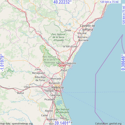
| Upper-left | 40.22232°, | -1.01979° |
| Center: | 39.68333°, | -0.31667° |
| Lower-right: | 39.1401°, | 0.38646° |
| Map W x H: | 120.3×120.3 km | = 74.8×74.8mi |
| max Lat: | 43.74134° ⇑74.7% North |
| Gilet: | 39.68333° |
| min Lat: | ⇓25.3% South 27.64134° |
| min Long | Gilet | max Long |
| -18.00367° | -0.31667° | 4.2899° |
| W 84.4%⇐ | ⇒15.6% E |
Elevation
Elevation of Gilet is 82 m = 269 ft, and this is 516 m = 1693 ft below average elevation for this country.
| Max E: |
1682 m = 5518 ft | 88.9% |
| Avg. | 598 m = 1962 ft | |
| Gilet | 82 m = 269 ft | |
Min E: |
0 m = 0 ft | 11.1% |
See also: Spain elevation on elevation.city.
Geographical zone
Gilet is located in North temperate zone (between Tropic of Cancer and the Arctic Circle). Distance of this Northern Tropic circle is 1806.5 km =1122.5 mi to South.| Distance of | km | miles | from Gilet |
|---|---|---|---|
| North Pole | 5594.7 | 3476.4 | to North |
| Arctic Circle | 2988.8 | 1857.2 | to North |
| Tropic Cancer | 1806.5 | 1122.5 | to South |
| Equator | 4412.4 | 2741.7 | to South |


Nearby cities:
15 places around Gilet: (largest is in red/bold)
• Albalat dels Tarongers
2.3 km =1.4 mi,  322°
322°
• Algimia de Alfara
8.6 km =5.3 mi,  330°
330°
• Benavites
8 km =5 mi,  45°
45°
• Benifairó de les Valls
7 km =4.3 mi,  37°
37°
• Canet d'En Berenguer
8.6 km =5.3 mi,  90°
90°
• Estivella
4.7 km =2.9 mi, 322°
• Faura
6.8 km =4.2 mi,  56°
56°
• Grao de Murviedro
8.1 km =5 mi,  124°
124°
• Náquera
9.3 km =5.8 mi,  246°
246°
• Petrés
1.4 km =0.9 mi, 90°
• Puçol
7.5 km =4.7 mi,  169°
169°
• Quart de les Valls
7 km =4.3 mi, 37°
• Quartell
7.5 km =4.7 mi, 36°
• Sagunto
4.3 km =2.7 mi, 90°
• Segart
4.3 km =2.7 mi,  270°
270°
Sources, notices
• [Note1] Compared only with cities in Spain existing in our database
• [Src1] Map data: © OpenStreetMap contributors (CC-BY-SA)
• [Src2] Other city data from geonames.org with taken over terms of usage.
• [Src3] Geographical zone / Annual Mean Temperature by Robert A. Rohde @ Wikipedia
