El Granado geodata
El Granado (Andalusia) is a populated place; located in Spain in Europe/Madrid (GMT+2) time zone. With population of 612 people, there are 3584 cities with bigger population in this country. Compared to other cities in Spain, 91.2% of cities are located further ↑North; 95.3% of cities are located further →East and 84.9% of cities have higher elevation than El Granado. Note1


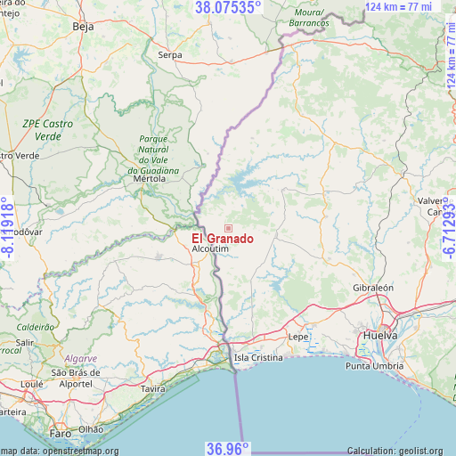
El Granado GPS coordinates[2]
37° 31' 11.136" North, 7° 24' 57.78" West
| Map corner | latitude | longitude |
|---|---|---|
| Upper-left | 38.07535°, | -8.11918° |
| Center: | 37.51976°, | -7.41605° |
| Lower-right: | 36.96°, | -6.71293° |
| Map W x H: | 124×124 km | = 77.1×77.1mi |
| max Lat: | 43.74134° ⇑91.2% North |
| El Granado: | 37.51976° |
| min Lat: | ⇓8.8% South 27.64134° |
| min Long | El Granado | max Long |
| -18.00367° | -7.41605° | 4.2899° |
| W 4.7%⇐ | ⇒95.3% E |
Elevation
Elevation of El Granado is 141 m = 463 ft, and this is 457 m = 1499 ft below average elevation for this country.
| Max E: |
1682 m = 5518 ft | 84.9% |
| Avg. | 598 m = 1962 ft | |
| El Granado | 141 m = 463 ft | |
Min E: |
0 m = 0 ft | 15.1% |
See also: Spain elevation on elevation.city.
Geographical zone
El Granado is located in North temperate zone (between Tropic of Cancer and the Arctic Circle). Distance of this Northern Tropic circle is 1565.9 km =973 mi to South.| Distance of | km | miles | from El Granado |
|---|---|---|---|
| North Pole | 5835.3 | 3625.9 | to North |
| Arctic Circle | 3229.4 | 2006.7 | to North |
| Tropic Cancer | 1565.9 | 973 | to South |
| Equator | 4171.8 | 2592.2 | to South |


Nearby cities:
15 places around El Granado: (largest is in red/bold)
• Alosno
26.8 km =16.7 mi,  83°
83°
• Ayamonte
34.1 km =21.2 mi,  178°
178°
• Cabezas Rubias
37 km =23 mi,  51°
51°
• Cartaya
35.4 km =22 mi,  138°
138°
• Isla Cristina
36.6 km =22.7 mi,  166°
166°
• Lepe
34.9 km =21.7 mi,  147°
147°
• Paymogo
25.3 km =15.7 mi,  14°
14°
• Puebla de Guzmán
18.1 km =11.2 mi, 54°
• San Bartolomé de la Torre
28.6 km =17.8 mi,  106°
106°
• San Silvestre de Guzmán
15.8 km =9.8 mi,  158°
158°
• Sanlúcar de Guadiana
6.8 km =4.2 mi,  219°
219°
• Santa Bárbara de Casa
36.8 km =22.9 mi,  33°
33°
• Villablanca
25 km =15.5 mi, 165°
• Villanueva de las Cruces
36.6 km =22.7 mi,  70°
70°
• Villanueva de los Castillejos
11.2 km =7 mi,  101°
101°
Sources, notices
• [Note1] Compared only with cities in Spain existing in our database
• [Src1] Map data: © OpenStreetMap contributors (CC-BY-SA)
• [Src2] Other city data from geonames.org with taken over terms of usage.
• [Src3] Geographical zone / Annual Mean Temperature by Robert A. Rohde @ Wikipedia
