Elda geodata
Elda (Valencia) is a seat of a third-order administrative division; located in Spain in Europe/Madrid (GMT+1) time zone. With population of 55,168 people, there are 170 cities with bigger population in this country. Compared to other cities in Spain, 85.8% of cities are located further ↑North; 79% of cities are located further ←West and 68.3% of cities have higher elevation than Elda. Note1


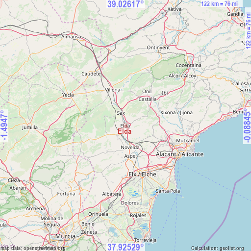
Elda GPS coordinates[2]
38° 28' 40.188" North, 0° 47' 29.652" West
| Map corner | latitude | longitude |
|---|---|---|
| Upper-left | 39.02617°, | -1.4947° |
| Center: | 38.47783°, | -0.79157° |
| Lower-right: | 37.92529°, | -0.08845° |
| Map W x H: | 122.4×122.4 km | = 76.1×76.1mi |
| max Lat: | 43.74134° ⇑85.8% North |
| Elda: | 38.47783° |
| min Lat: | ⇓14.2% South 27.64134° |
| min Long | Elda | max Long |
| -18.00367° | -0.79157° | 4.2899° |
| W 79%⇐ | ⇒21% E |
Elevation
Elevation of Elda is 412 m = 1352 ft, and this is 186 m = 610 ft below average elevation for this country.
| Max E: |
1682 m = 5518 ft | 68.3% |
| Avg. | 598 m = 1962 ft | |
| Elda | 412 m = 1352 ft | |
Min E: |
0 m = 0 ft | 31.7% |
See also: Elda elevation on elevation.city.
Geographical zone
Elda is located in North temperate zone (between Tropic of Cancer and the Arctic Circle). Distance of this Northern Tropic circle is 1672.4 km =1039.2 mi to South.| Distance of | km | miles | from Elda |
|---|---|---|---|
| North Pole | 5728.7 | 3559.6 | to North |
| Arctic Circle | 3122.8 | 1940.4 | to North |
| Tropic Cancer | 1672.4 | 1039.2 | to South |
| Equator | 4278.3 | 2658.4 | to South |


Nearby cities:
15 places around Elda: (largest is in red/bold)
• Agost
14 km =8.7 mi,  107°
107°
• Aspe
14.9 km =9.3 mi,  171°
171°
• Biar
17.2 km =10.7 mi,  7°
7°
• Castalla
16.8 km =10.4 mi,  38°
38°
• Cañada
21.9 km =13.6 mi,  355°
355°
• Hondón de las Nieves
19.6 km =12.2 mi,  195°
195°
• La Romana
15.4 km =9.6 mi,  217°
217°
• Monforte del Cid
12.2 km =7.6 mi,  153°
153°
• Monóvar
6.1 km =3.8 mi, 224°
• Novelda
10.6 km =6.6 mi, 168°
• Onil
19.4 km =12.1 mi,  32°
32°
• Salinas
11.5 km =7.1 mi,  294°
294°
• Sax
7 km =4.3 mi,  340°
340°
• Tibi
19.5 km =12.1 mi,  72°
72°
• Villena
18.9 km =11.7 mi, 340°
Sources, notices
• [Note1] Compared only with cities in Spain existing in our database
• [Src1] Map data: © OpenStreetMap contributors (CC-BY-SA)
• [Src2] Other city data from geonames.org with taken over terms of usage.
• [Src3] Geographical zone / Annual Mean Temperature by Robert A. Rohde @ Wikipedia
