Castañar de Ibor geodata
Castañar de Ibor (Extremadura) is a populated place; located in Spain in Europe/Madrid (GMT+2) time zone. With population of 1,179 people, there are 2739 cities with bigger population in this country. Compared to other cities in Spain, 75.3% of cities are located further ↑North; 77.6% of cities are located further →East and 50.8% of cities have higher elevation than Castañar de Ibor. Note1
Administrative division(s):
- Level 1: Extremadura
- Level 2: Provincia de Cáceres
- Level 3: Navalvillar de Ibor


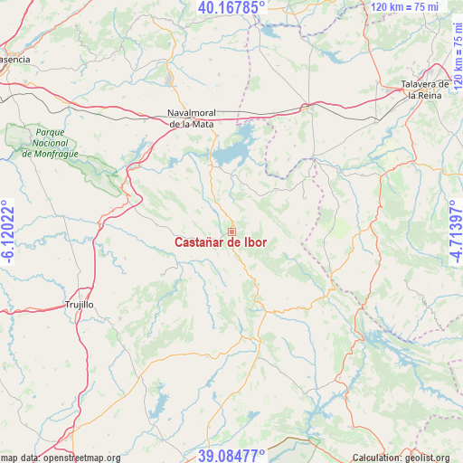
Castañar de Ibor GPS coordinates[2]
39° 37' 42.348" North, 5° 25' 1.524" West
| Map corner | latitude | longitude |
|---|---|---|
| Upper-left | 40.16785°, | -6.12022° |
| Center: | 39.62843°, | -5.41709° |
| Lower-right: | 39.08477°, | -4.71397° |
| Map W x H: | 120.4×120.4 km | = 74.8×74.8mi |
| max Lat: | 43.74134° ⇑75.3% North |
| Castañar de Ibor: | 39.62843° |
| min Lat: | ⇓24.7% South 27.64134° |
| min Long | Castañar de Ib | max Long |
| -18.00367° | -5.41709° | 4.2899° |
| W 22.4%⇐ | ⇒77.6% E |
Elevation
Elevation of Castañar de Ibor is 650 m = 2133 ft, and this is 52 m = 171 ft above average elevation for this country.
| Max E: |
1682 m = 5518 ft | 50.8% |
| Castañar de Ibor | 650 m 2133 ft | |
| Avg. | 598 m = 1962 ft | |
Min E: |
0 m = 0 ft | 49.2% |
See also: Spain elevation on elevation.city.
Geographical zone
Castañar de Ibor is located in North temperate zone (between Tropic of Cancer and the Arctic Circle). Distance of this Northern Tropic circle is 1800.3 km =1118.7 mi to South.| Distance of | km | miles | from Castañar de Ibor |
|---|---|---|---|
| North Pole | 5600.8 | 3480.2 | to North |
| Arctic Circle | 2994.9 | 1860.9 | to North |
| Tropic Cancer | 1800.3 | 1118.7 | to South |
| Equator | 4406.3 | 2737.9 | to South |


Nearby cities:
15 places around Castañar de Ibor: (largest is in red/bold)
• Bohonal de Ibor
18.3 km =11.4 mi,  341°
341°
• Cabañas del Castillo
12.1 km =7.5 mi,  222°
222°
• Campillo de Deleitosa
15.8 km =9.8 mi,  301°
301°
• Carrascalejo
17.2 km =10.7 mi,  88°
88°
• Deleitosa
19.7 km =12.2 mi,  274°
274°
• Fresnedoso de Ibor
10 km =6.2 mi,  308°
308°
• Garvín
11.8 km =7.3 mi,  30°
30°
• Guadalupe
21.2 km =13.2 mi,  158°
158°
• Mesas de Ibor
18 km =11.2 mi,  322°
322°
• Navalvillar de Ibor
5 km =3.1 mi,  176°
176°
• Navezuelas
13.4 km =8.3 mi,  187°
187°
• Peraleda de San Román
12.8 km =8 mi,  11°
11°
• Robledollano
8.1 km =5 mi,  255°
255°
• Valdelacasa de Tajo
15.8 km =9.8 mi,  46°
46°
• Villar del Pedroso
20.8 km =12.9 mi,  65°
65°
Sources, notices
• [Note1] Compared only with cities in Spain existing in our database
• [Src1] Map data: © OpenStreetMap contributors (CC-BY-SA)
• [Src2] Other city data from geonames.org with taken over terms of usage.
• [Src3] Geographical zone / Annual Mean Temperature by Robert A. Rohde @ Wikipedia
