Carrascalejo geodata
Carrascalejo (Extremadura) is a seat of a third-order administrative division; located in Spain in Europe/Madrid (GMT+2) time zone. In our database, there are 6762 cities with bigger population. Compared to other cities in Spain, 75.3% of cities are located further ↑North; 75.3% of cities are located further →East and 52.3% of cities have higher elevation than Carrascalejo. Note1
Administrative division(s):
- Level 1: Extremadura
- Level 2: Provincia de Cáceres
- Level 3: Carrascalejo


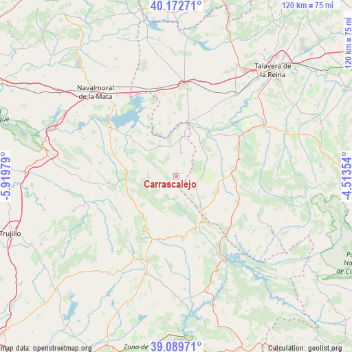
Carrascalejo GPS coordinates[2]
39° 37' 59.988" North, 5° 13' 0.012" West
| Map corner | latitude | longitude |
|---|---|---|
| Upper-left | 40.17271°, | -5.91979° |
| Center: | 39.63333°, | -5.21667° |
| Lower-right: | 39.08971°, | -4.51354° |
| Map W x H: | 120.4×120.4 km | = 74.8×74.8mi |
| max Lat: | 43.74134° ⇑75.3% North |
| Carrascalejo: | 39.63333° |
| min Lat: | ⇓24.7% South 27.64134° |
| min Long | Carrascalejo | max Long |
| -18.00367° | -5.21667° | 4.2899° |
| W 24.7%⇐ | ⇒75.3% E |
Elevation
Elevation of Carrascalejo is 633 m = 2077 ft, and this is 35 m = 115 ft above average elevation for this country.
| Max E: |
1682 m = 5518 ft | 52.3% |
| Carrascalejo | 633 m 2077 ft | |
| Avg. | 598 m = 1962 ft | |
Min E: |
0 m = 0 ft | 47.7% |
See also: Spain elevation on elevation.city.
Geographical zone
Carrascalejo is located in North temperate zone (between Tropic of Cancer and the Arctic Circle). Distance of this Northern Tropic circle is 1800.9 km =1119 mi to South.| Distance of | km | miles | from Carrascalejo |
|---|---|---|---|
| North Pole | 5600.2 | 3479.8 | to North |
| Arctic Circle | 2994.4 | 1860.6 | to North |
| Tropic Cancer | 1800.9 | 1119 | to South |
| Equator | 4406.8 | 2738.3 | to South |


Nearby cities:
15 places around Carrascalejo: (largest is in red/bold)
• Alcolea de Tajo
20.5 km =12.7 mi,  16°
16°
• Aldeanueva de San Bartolomé
8.9 km =5.5 mi,  88°
88°
• Azután
18.6 km =11.6 mi, 24°
• Castañar de Ibor
17.2 km =10.7 mi,  268°
268°
• El Puente del Arzobispo
19.1 km =11.9 mi,  11°
11°
• Garvín
14.7 km =9.1 mi,  310°
310°
• La Nava de Ricomalillo
19.4 km =12.1 mi,  84°
84°
• Mohedas de la Jara
7.1 km =4.4 mi,  117°
117°
• Navalmoralejo
13.3 km =8.3 mi,  27°
27°
• Navalvillar de Ibor
17.7 km =11 mi,  251°
251°
• Peraleda de San Román
18.9 km =11.7 mi, 309°
• Puerto de San Vicente
15.1 km =9.4 mi,  144°
144°
• Valdelacasa de Tajo
11.8 km =7.3 mi,  331°
331°
• Valdeverdeja
18.3 km =11.4 mi,  352°
352°
• Villar del Pedroso
8.3 km =5.2 mi, 12°
Sources, notices
• [Note1] Compared only with cities in Spain existing in our database
• [Src1] Map data: © OpenStreetMap contributors (CC-BY-SA)
• [Src2] Other city data from geonames.org with taken over terms of usage.
• [Src3] Geographical zone / Annual Mean Temperature by Robert A. Rohde @ Wikipedia
