Casasbuenas geodata
Casasbuenas (Castille-La Mancha) is a seat of a third-order administrative division; located in Spain in Europe/Madrid (GMT+2) time zone. With population of 209 people, there are 4989 cities with bigger population in this country. Compared to other cities in Spain, 73.4% of cities are located further ↑North; 61.6% of cities are located further →East and 52.6% of cities have lower elevation than Casasbuenas. Note1
Administrative division(s):
- Level 1: Castille-La Mancha
- Level 2: Province of Toledo
- Level 3: Casasbuenas


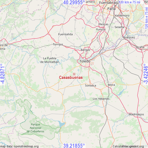
Casasbuenas GPS coordinates[2]
39° 45' 40.212" North, 4° 7' 32.088" West
| Map corner | latitude | longitude |
|---|---|---|
| Upper-left | 40.29955°, | -4.82871° |
| Center: | 39.76117°, | -4.12558° |
| Lower-right: | 39.21855°, | -3.42246° |
| Map W x H: | 120.2×120.2 km | = 74.7×74.7mi |
| max Lat: | 43.74134° ⇑73.4% North |
| Casasbuenas: | 39.76117° |
| min Lat: | ⇓26.6% South 27.64134° |
| min Long | Casasbuenas | max Long |
| -18.00367° | -4.12558° | 4.2899° |
| W 38.4%⇐ | ⇒61.6% E |
Elevation
Elevation of Casasbuenas is 686 m = 2251 ft, and this is 88 m = 289 ft above average elevation for this country.
| Max E: |
1682 m = 5518 ft | 47.4% |
| Casasbuenas | 686 m 2251 ft | |
| Avg. | 598 m = 1962 ft | |
Min E: |
0 m = 0 ft | 52.6% |
See also: Spain elevation on elevation.city.
Geographical zone
Casasbuenas is located in North temperate zone (between Tropic of Cancer and the Arctic Circle). Distance of this Northern Tropic circle is 1815.1 km =1127.9 mi to South.| Distance of | km | miles | from Casasbuenas |
|---|---|---|---|
| North Pole | 5586 | 3471 | to North |
| Arctic Circle | 2980.1 | 1851.7 | to North |
| Tropic Cancer | 1815.1 | 1127.9 | to South |
| Equator | 4421 | 2747.1 | to South |


Nearby cities:
15 places around Casasbuenas: (largest is in red/bold)
• Ajofrín
13.5 km =8.4 mi,  114°
114°
• Burguillos de Toledo
12 km =7.5 mi,  71°
71°
• Chueca
15.9 km =9.9 mi,  101°
101°
• Cobisa
9.8 km =6.1 mi,  60°
60°
• Cuerva
13.1 km =8.1 mi,  213°
213°
• Guadamur
6 km =3.7 mi,  340°
340°
• Gálvez
14.2 km =8.8 mi,  242°
242°
• Layos
5.5 km =3.4 mi, 71°
• Mazarambroz
11.7 km =7.3 mi,  129°
129°
• Noez
5.5 km =3.4 mi,  245°
245°
• Polán
4.7 km =2.9 mi,  309°
309°
• Pulgar
7.8 km =4.8 mi,  196°
196°
• Sonseca
15.9 km =9.9 mi, 125°
• Toledo
13.9 km =8.6 mi,  39°
39°
• Totanés
10.3 km =6.4 mi, 236°
Sources, notices
• [Note1] Compared only with cities in Spain existing in our database
• [Src1] Map data: © OpenStreetMap contributors (CC-BY-SA)
• [Src2] Other city data from geonames.org with taken over terms of usage.
• [Src3] Geographical zone / Annual Mean Temperature by Robert A. Rohde @ Wikipedia
