Zarzuela geodata
Zarzuela (Castille-La Mancha) is a seat of a third-order administrative division; located in Spain in Europe/Madrid (GMT+2) time zone. With population of 262 people, there are 4676 cities with bigger population in this country. Compared to other cities in Spain, 66.3% of cities are located further ↑North; 66% of cities are located further ←West and 94.9% of cities have lower elevation than Zarzuela. Note1
Administrative division(s):
- Level 1: Castille-La Mancha
- Level 2: Provincia de Cuenca
- Level 3: Zarzuela


Zarzuela GPS coordinates[2]
40° 15' 32.472" North, 2° 6' 37.224" West
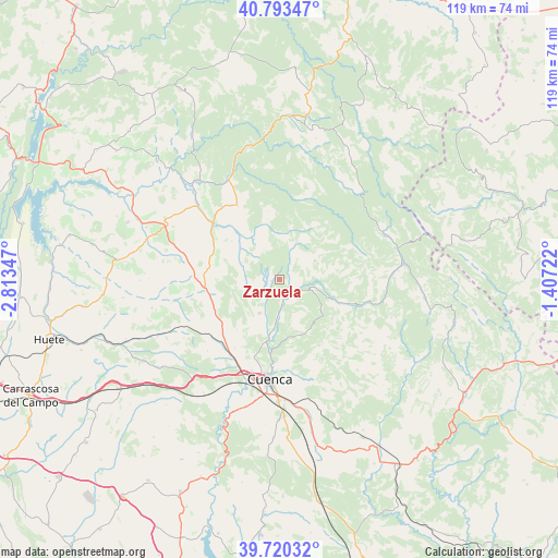
| Map corner | latitude | longitude |
|---|---|---|
| Upper-left | 40.79347°, | -2.81347° |
| Center: | 40.25902°, | -2.11034° |
| Lower-right: | 39.72032°, | -1.40722° |
| Map W x H: | 119.3×119.3 km | = 74.1×74.1mi |
| max Lat: | 43.74134° ⇑66.3% North |
| Zarzuela: | 40.25902° |
| min Lat: | ⇓33.7% South 27.64134° |
| min Long | Zarzuela | max Long |
| -18.00367° | -2.11034° | 4.2899° |
| W 66%⇐ | ⇒34% E |
Elevation
Elevation of Zarzuela is 1136 m = 3727 ft, and this is 538 m = 1765 ft above average elevation for this country.
| Max E: |
1682 m = 5518 ft | 5.1% |
| Zarzuela | 1136 m 3727 ft | |
| Avg. | 598 m = 1962 ft | |
Min E: |
0 m = 0 ft | 94.9% |
See also: Spain elevation on elevation.city.
Geographical zone
Zarzuela is located in North temperate zone (between Tropic of Cancer and the Arctic Circle). Distance of this Northern Tropic circle is 1870.5 km =1162.3 mi to South.| Distance of | km | miles | from Zarzuela |
|---|---|---|---|
| North Pole | 5530.7 | 3436.6 | to North |
| Arctic Circle | 2924.8 | 1817.4 | to North |
| Tropic Cancer | 1870.5 | 1162.3 | to South |
| Equator | 4476.4 | 2781.5 | to South |


Nearby cities:
15 places around Zarzuela: (largest is in red/bold)
• Albalate de las Nogueras
18.5 km =11.5 mi,  310°
310°
• Arcos de la Sierra
9.7 km =6 mi,  358°
358°
• Arrancacepas
21.7 km =13.5 mi,  283°
283°
• Bascuñana de San Pedro
11.2 km =7 mi,  243°
243°
• Castillejo-Sierra
13.1 km =8.1 mi,  348°
348°
• Chillarón de Cuenca
19.5 km =12.1 mi,  209°
209°
• Cuenca
21.5 km =13.4 mi,  185°
185°
• Fresneda de la Sierra
14.9 km =9.3 mi, 349°
• La Frontera
18.3 km =11.4 mi,  330°
330°
• Mariana
10.7 km =6.6 mi,  196°
196°
• Portilla
4.2 km =2.6 mi,  35°
35°
• Torralba
15.6 km =9.7 mi,  288°
288°
• Uña
11.9 km =7.4 mi,  109°
109°
• Villalba de la Sierra
3.3 km =2.1 mi,  146°
146°
• Villar de Domingo García
15.6 km =9.7 mi,  261°
261°
Sources, notices
• [Note1] Compared only with cities in Spain existing in our database
• [Src1] Map data: © OpenStreetMap contributors (CC-BY-SA)
• [Src2] Other city data from geonames.org with taken over terms of usage.
• [Src3] Geographical zone / Annual Mean Temperature by Robert A. Rohde @ Wikipedia
