Cuenca geodata
Cuenca (Castille-La Mancha) is a seat of a second-order administrative division; located in Spain in Europe/Madrid (GMT+2) time zone. With population of 55,866 people, there are 168 cities with bigger population in this country. Compared to other cities in Spain, 69.2% of cities are located further ↑North; 65.7% of cities are located further ←West and 84.1% of cities have lower elevation than Cuenca. Note1
Administrative division(s):
- Level 1: Castille-La Mancha
- Level 2: Provincia de Cuenca
- Level 3: Cuenca


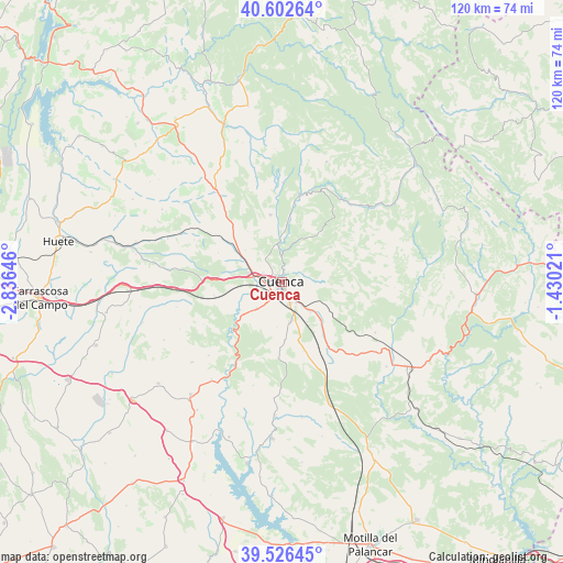
Cuenca GPS coordinates[2]
40° 4' 0.012" North, 2° 7' 59.988" West
| Map corner | latitude | longitude |
|---|---|---|
| Upper-left | 40.60264°, | -2.83646° |
| Center: | 40.06667°, | -2.13333° |
| Lower-right: | 39.52645°, | -1.43021° |
| Map W x H: | 119.7×119.7 km | = 74.4×74.4mi |
| max Lat: | 43.74134° ⇑69.2% North |
| Cuenca: | 40.06667° |
| min Lat: | ⇓30.8% South 27.64134° |
| min Long | Cuenca | max Long |
| -18.00367° | -2.13333° | 4.2899° |
| W 65.7%⇐ | ⇒34.3% E |
Elevation
Elevation of Cuenca is 941 m = 3087 ft, and this is 343 m = 1125 ft above average elevation for this country.
| Max E: |
1682 m = 5518 ft | 15.9% |
| Cuenca | 941 m 3087 ft | |
| Avg. | 598 m = 1962 ft | |
Min E: |
0 m = 0 ft | 84.1% |
See also: Cuenca elevation on elevation.city.
Geographical zone
Cuenca is located in North temperate zone (between Tropic of Cancer and the Arctic Circle). Distance of this Northern Tropic circle is 1849.1 km =1149 mi to South.| Distance of | km | miles | from Cuenca |
|---|---|---|---|
| North Pole | 5552.1 | 3449.9 | to North |
| Arctic Circle | 2946.2 | 1830.7 | to North |
| Tropic Cancer | 1849.1 | 1149 | to South |
| Equator | 4455 | 2768.2 | to South |


Nearby cities:
15 places around Cuenca: (largest is in red/bold)
• Altarejos
25.6 km =15.9 mi,  228°
228°
• Bascuñana de San Pedro
18.2 km =11.3 mi,  333°
333°
• Cañada del Hoyo
22.8 km =14.2 mi,  119°
119°
• Chillarón de Cuenca
8.7 km =5.4 mi,  299°
299°
• Fresneda de Altarejos
22 km =13.7 mi,  224°
224°
• Fuentes
14.9 km =9.3 mi,  138°
138°
• Mariana
11.2 km =7 mi,  354°
354°
• Mota de Altarejos
25.4 km =15.8 mi, 216°
• Portilla
25.2 km =15.7 mi,  10°
10°
• Uña
21.9 km =13.6 mi,  37°
37°
• Villalba de la Sierra
19 km =11.8 mi, 11°
• Villar de Domingo García
23.2 km =14.4 mi,  324°
324°
• Villar de Olalla
7.8 km =4.8 mi, 222°
• Villarejo de la Peñuela
23.6 km =14.7 mi,  275°
275°
• Zarzuela
21.5 km =13.4 mi, 5°
Sources, notices
• [Note1] Compared only with cities in Spain existing in our database
• [Src1] Map data: © OpenStreetMap contributors (CC-BY-SA)
• [Src2] Other city data from geonames.org with taken over terms of usage.
• [Src3] Geographical zone / Annual Mean Temperature by Robert A. Rohde @ Wikipedia
