Portilla geodata
Portilla (Castille-La Mancha) is a seat of a third-order administrative division; located in Spain in Europe/Madrid (GMT+2) time zone. With population of 101 people, there are 5924 cities with bigger population in this country. Compared to other cities in Spain, 66% of cities are located further ↑North; 66.5% of cities are located further ←West and 92.1% of cities have lower elevation than Portilla. Note1
Administrative division(s):
- Level 1: Castille-La Mancha
- Level 2: Provincia de Cuenca
- Level 3: Portilla


Portilla GPS coordinates[2]
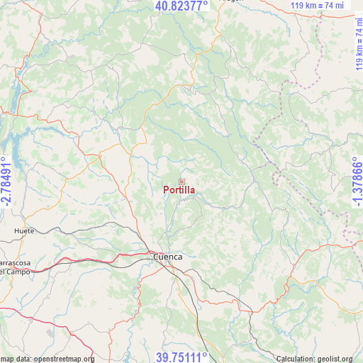
40° 17' 22.452" North, 2° 4' 54.408" West
| Map corner | latitude | longitude |
|---|---|---|
| Upper-left | 40.82377°, | -2.78491° |
| Center: | 40.28957°, | -2.08178° |
| Lower-right: | 39.75111°, | -1.37866° |
| Map W x H: | 119.3×119.3 km | = 74.1×74.1mi |
| max Lat: | 43.74134° ⇑66% North |
| Portilla: | 40.28957° |
| min Lat: | ⇓34% South 27.64134° |
| min Long | Portilla | max Long |
| -18.00367° | -2.08178° | 4.2899° |
| W 66.5%⇐ | ⇒33.5% E |
Elevation
Elevation of Portilla is 1070 m = 3510 ft, and this is 472 m = 1549 ft above average elevation for this country.
| Max E: |
1682 m = 5518 ft | 7.9% |
| Portilla | 1070 m 3510 ft | |
| Avg. | 598 m = 1962 ft | |
Min E: |
0 m = 0 ft | 92.1% |
See also: Spain elevation on elevation.city.
Geographical zone
Portilla is located in North temperate zone (between Tropic of Cancer and the Arctic Circle). Distance of this Northern Tropic circle is 1873.9 km =1164.4 mi to South.| Distance of | km | miles | from Portilla |
|---|---|---|---|
| North Pole | 5527.3 | 3434.5 | to North |
| Arctic Circle | 2921.4 | 1815.3 | to North |
| Tropic Cancer | 1873.9 | 1164.4 | to South |
| Equator | 4479.8 | 2783.6 | to South |


Nearby cities:
15 places around Portilla: (largest is in red/bold)
• Albalate de las Nogueras
18.6 km =11.6 mi,  297°
297°
• Arcos de la Sierra
6.9 km =4.3 mi,  337°
337°
• Bascuñana de San Pedro
15 km =9.3 mi,  235°
235°
• Castillejo-Sierra
10.7 km =6.6 mi,  332°
332°
• Cañamares
22.5 km =14 mi,  323°
323°
• Fresneda de la Sierra
12.4 km =7.7 mi, 335°
• Fuertescusa
22.2 km =13.8 mi, 338°
• La Frontera
16.9 km =10.5 mi, 317°
• Mariana
14.7 km =9.1 mi,  201°
201°
• Torralba
17.3 km =10.7 mi,  274°
274°
• Uña
11.4 km =7.1 mi,  129°
129°
• Vega del Codorno
20.7 km =12.9 mi,  43°
43°
• Villalba de la Sierra
6.2 km =3.9 mi,  185°
185°
• Villar de Domingo García
18.7 km =11.6 mi,  251°
251°
• Zarzuela
4.2 km =2.6 mi,  215°
215°
Sources, notices
• [Note1] Compared only with cities in Spain existing in our database
• [Src1] Map data: © OpenStreetMap contributors (CC-BY-SA)
• [Src2] Other city data from geonames.org with taken over terms of usage.
• [Src3] Geographical zone / Annual Mean Temperature by Robert A. Rohde @ Wikipedia
