Zamarra geodata
Zamarra (Castille and León) is a seat of a third-order administrative division; located in Spain in Europe/Madrid (GMT+2) time zone. With population of 136 people, there are 5534 cities with bigger population in this country. Compared to other cities in Spain, 61.4% of cities are located further ↑North; 90.8% of cities are located further →East and 65.5% of cities have lower elevation than Zamarra. Note1
Administrative division(s):
- Level 1: Castille and León
- Level 2: Provincia de Salamanca
- Level 3: Zamarra


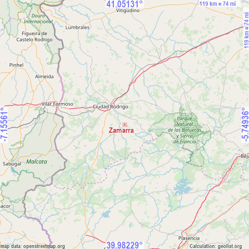
Zamarra GPS coordinates[2]
40° 31' 8.148" North, 6° 27' 8.928" West
| Map corner | latitude | longitude |
|---|---|---|
| Upper-left | 41.05131°, | -7.15561° |
| Center: | 40.51893°, | -6.45248° |
| Lower-right: | 39.98229°, | -5.74936° |
| Map W x H: | 118.9×118.9 km | = 73.9×73.9mi |
| max Lat: | 43.74134° ⇑61.4% North |
| Zamarra: | 40.51893° |
| min Lat: | ⇓38.6% South 27.64134° |
| min Long | Zamarra | max Long |
| -18.00367° | -6.45248° | 4.2899° |
| W 9.2%⇐ | ⇒90.8% E |
Elevation
Elevation of Zamarra is 781 m = 2562 ft, and this is 183 m = 600 ft above average elevation for this country.
| Max E: |
1682 m = 5518 ft | 34.5% |
| Zamarra | 781 m 2562 ft | |
| Avg. | 598 m = 1962 ft | |
Min E: |
0 m = 0 ft | 65.5% |
See also: Spain elevation on elevation.city.
Geographical zone
Zamarra is located in North temperate zone (between Tropic of Cancer and the Arctic Circle). Distance of this Northern Tropic circle is 1899.4 km =1180.2 mi to South.| Distance of | km | miles | from Zamarra |
|---|---|---|---|
| North Pole | 5501.8 | 3418.7 | to North |
| Arctic Circle | 2895.9 | 1799.4 | to North |
| Tropic Cancer | 1899.4 | 1180.2 | to South |
| Equator | 4505.3 | 2799.5 | to South |


Nearby cities:
15 places around Zamarra: (largest is in red/bold)
• Agallas
7.9 km =4.9 mi,  173°
173°
• Campillo de Azaba
19.9 km =12.4 mi,  266°
266°
• Carpio de Azaba
18.5 km =11.5 mi,  297°
297°
• Casares de las Hurdes
17.2 km =10.7 mi,  123°
123°
• Ciudad Rodrigo
11.3 km =7 mi,  322°
322°
• Dios le Guarde
18 km =11.2 mi,  40°
40°
• Herguijuela de Ciudad Rodrigo
8.9 km =5.5 mi,  220°
220°
• Martiago
7.9 km =4.9 mi,  203°
203°
• Monsagro
15.4 km =9.6 mi,  96°
96°
• Morasverdes
17.5 km =10.9 mi,  58°
58°
• Pastores
4.9 km =3 mi,  264°
264°
• Robleda
19.9 km =12.4 mi, 221°
• Serradilla del Arroyo
7.8 km =4.8 mi,  88°
88°
• Serradilla del Llano
8.3 km =5.2 mi, 104°
• Tenebrón
14.4 km =8.9 mi, 35°
Sources, notices
• [Note1] Compared only with cities in Spain existing in our database
• [Src1] Map data: © OpenStreetMap contributors (CC-BY-SA)
• [Src2] Other city data from geonames.org with taken over terms of usage.
• [Src3] Geographical zone / Annual Mean Temperature by Robert A. Rohde @ Wikipedia
