Villasana de Mena geodata
Villasana de Mena (Castille and León) is a populated place; located in Spain in Europe/Madrid (GMT+2) time zone. With population of 3,427 people, there are 1605 cities with bigger population in this country. Compared to other cities in Spain, 95.3% of cities are located further ↓South; 50.6% of cities are located further ←West and 73.8% of cities have higher elevation than Villasana de Mena. Note1
Administrative division(s):
- Level 1: Castille and León
- Level 2: Provincia de Burgos
- Level 3: Valle de Mena


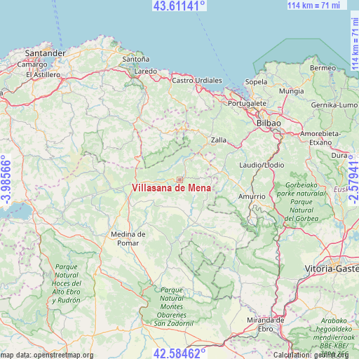
Villasana de Mena GPS coordinates[2]
43° 6' 0.612" North, 3° 16' 57.108" West
| Map corner | latitude | longitude |
|---|---|---|
| Upper-left | 43.61141°, | -3.98566° |
| Center: | 43.10017°, | -3.28253° |
| Lower-right: | 42.58462°, | -2.57941° |
| Map W x H: | 114.2×114.2 km | = 71×71mi |
| max Lat: | 43.74134° ⇑4.7% North |
| Villasana de Mena: | 43.10017° |
| min Lat: | ⇓95.3% South 27.64134° |
| min Long | Villasana de Me | max Long |
| -18.00367° | -3.28253° | 4.2899° |
| W 50.6%⇐ | ⇒49.4% E |
Elevation
Elevation of Villasana de Mena is 318 m = 1043 ft, and this is 280 m = 919 ft below average elevation for this country.
| Max E: |
1682 m = 5518 ft | 73.8% |
| Avg. | 598 m = 1962 ft | |
| Villasana de Mena | 318 m = 1043 ft | |
Min E: |
0 m = 0 ft | 26.2% |
See also: Spain elevation on elevation.city.
Geographical zone
Villasana de Mena is located in North temperate zone (between Tropic of Cancer and the Arctic Circle). Distance of this Northern Tropic circle is 2186.4 km =1358.6 mi to South.| Distance of | km | miles | from Villasana de Mena |
|---|---|---|---|
| North Pole | 5214.8 | 3240.3 | to North |
| Arctic Circle | 2608.9 | 1621.1 | to North |
| Tropic Cancer | 2186.4 | 1358.6 | to South |
| Equator | 4792.3 | 2977.8 | to South |


Nearby cities:
15 places around Villasana de Mena: (largest is in red/bold)
• Amurrio
23.6 km =14.7 mi,  103°
103°
• Avellaneda
17.4 km =10.8 mi,  34°
34°
• Balmaseda
13 km =8.1 mi, 31°
• Espinosa de los Monteros
22.2 km =13.8 mi,  263°
263°
• Gordexola
18.9 km =11.7 mi,  62°
62°
• Güeñes
19.7 km =12.2 mi,  50°
50°
• Lanestosa
18.4 km =11.4 mi,  316°
316°
• Laudio / Llodio
26.4 km =16.4 mi,  79°
79°
• Medina de Pomar
25.3 km =15.7 mi,  221°
221°
• Ramales de la Victoria
22.9 km =14.2 mi, 319°
• Rasines
25.7 km =16 mi,  332°
332°
• San Pedro Galdames
22.3 km =13.9 mi,  41°
41°
• Sopuerta
20.8 km =12.9 mi, 29°
• Urduña / Orduña
25.1 km =15.6 mi,  117°
117°
• Zalla
19.1 km =11.9 mi, 39°
Sources, notices
• [Note1] Compared only with cities in Spain existing in our database
• [Src1] Map data: © OpenStreetMap contributors (CC-BY-SA)
• [Src2] Other city data from geonames.org with taken over terms of usage.
• [Src3] Geographical zone / Annual Mean Temperature by Robert A. Rohde @ Wikipedia
