Güeñes geodata
Güeñes (Basque Country) is a populated place; located in Spain in Europe/Madrid (GMT+2) time zone. With population of 6,147 people, there are 1118 cities with bigger population in this country. Compared to other cities in Spain, 96.5% of cities are located further ↓South; 52.9% of cities are located further ←West and 89.1% of cities have higher elevation than Güeñes. Note1


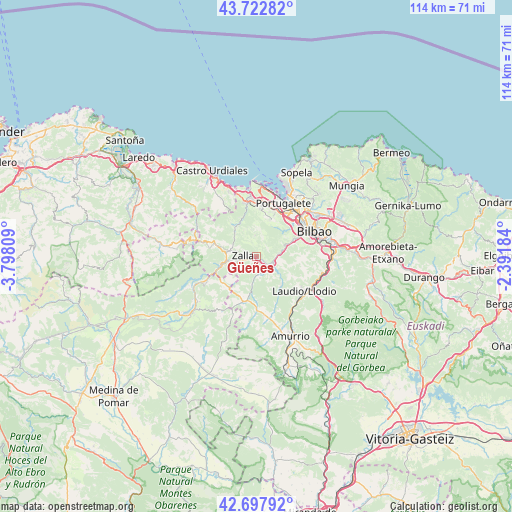
Güeñes GPS coordinates[2]
43° 12' 45.072" North, 3° 5' 41.892" West
| Map corner | latitude | longitude |
|---|---|---|
| Upper-left | 43.72282°, | -3.79809° |
| Center: | 43.21252°, | -3.09497° |
| Lower-right: | 42.69792°, | -2.39184° |
| Map W x H: | 114×114 km | = 70.8×70.8mi |
| max Lat: | 43.74134° ⇑3.5% North |
| Güeñes: | 43.21252° |
| min Lat: | ⇓96.5% South 27.64134° |
| min Long | Güeñes | max Long |
| -18.00367° | -3.09497° | 4.2899° |
| W 52.9%⇐ | ⇒47.1% E |
Elevation
Elevation of Güeñes is 80 m = 262 ft, and this is 518 m = 1699 ft below average elevation for this country.
| Max E: |
1682 m = 5518 ft | 89.1% |
| Avg. | 598 m = 1962 ft | |
| Güeñes | 80 m = 262 ft | |
Min E: |
0 m = 0 ft | 10.9% |
See also: Spain elevation on elevation.city.
Geographical zone
Güeñes is located in North temperate zone (between Tropic of Cancer and the Arctic Circle). Distance of this Northern Tropic circle is 2198.9 km =1366.3 mi to South.| Distance of | km | miles | from Güeñes |
|---|---|---|---|
| North Pole | 5202.3 | 3232.6 | to North |
| Arctic Circle | 2596.4 | 1613.3 | to North |
| Tropic Cancer | 2198.9 | 1366.3 | to South |
| Equator | 4804.8 | 2985.6 | to South |


Nearby cities:
15 places around Güeñes: (largest is in red/bold)
• Alonsotegi
9.4 km =5.8 mi,  67°
67°
• Avellaneda
5.7 km =3.5 mi,  289°
289°
• Balmaseda
8.6 km =5.3 mi,  260°
260°
• Barakaldo
12.7 km =7.9 mi,  42°
42°
• Erandio
14.2 km =8.8 mi, 43°
• Gordexola
4.1 km =2.5 mi,  157°
157°
• Laudio / Llodio
13.2 km =8.2 mi,  125°
125°
• Ortuella
11.4 km =7.1 mi,  15°
15°
• Portugalete
13.5 km =8.4 mi,  26°
26°
• San Julián de Muskiz
13.4 km =8.3 mi,  358°
358°
• San Pedro Galdames
4.2 km =2.6 mi,  354°
354°
• Santurtzi
13.8 km =8.6 mi, 21°
• Sestao
12.9 km =8 mi, 33°
• Sopuerta
7.4 km =4.6 mi,  318°
318°
• Zalla
3.9 km =2.4 mi,  306°
306°
Sources, notices
• [Note1] Compared only with cities in Spain existing in our database
• [Src1] Map data: © OpenStreetMap contributors (CC-BY-SA)
• [Src2] Other city data from geonames.org with taken over terms of usage.
• [Src3] Geographical zone / Annual Mean Temperature by Robert A. Rohde @ Wikipedia
