Villar del Infantado geodata
Villar del Infantado (Castille-La Mancha) is a seat of a third-order administrative division; located in Spain in Europe/Madrid (GMT+2) time zone. With population of 50 people, there are 6463 cities with bigger population in this country. Compared to other cities in Spain, 62.8% of cities are located further ↑North; 61.2% of cities are located further ←West and 63.7% of cities have lower elevation than Villar del Infantado. Note1
Administrative division(s):
- Level 1: Castille-La Mancha
- Level 2: Provincia de Cuenca
- Level 3: Villar del Infantado


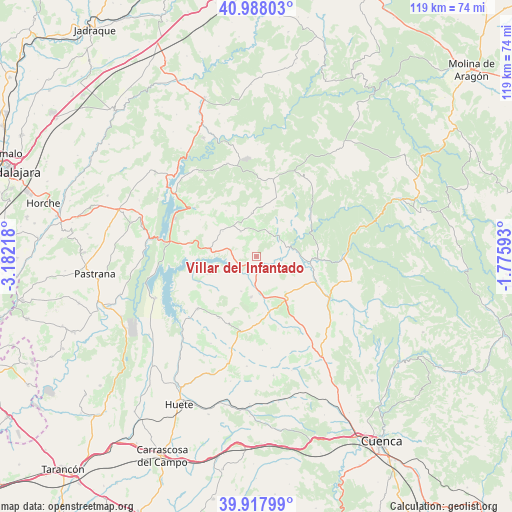
Villar del Infantado GPS coordinates[2]
40° 27' 18.504" North, 2° 28' 44.58" West
| Map corner | latitude | longitude |
|---|---|---|
| Upper-left | 40.98803°, | -3.18218° |
| Center: | 40.45514°, | -2.47905° |
| Lower-right: | 39.91799°, | -1.77593° |
| Map W x H: | 119×119 km | = 73.9×73.9mi |
| max Lat: | 43.74134° ⇑62.8% North |
| Villar del Infantado: | 40.45514° |
| min Lat: | ⇓37.2% South 27.64134° |
| min Long | Villar del Infa | max Long |
| -18.00367° | -2.47905° | 4.2899° |
| W 61.2%⇐ | ⇒38.8% E |
Elevation
Elevation of Villar del Infantado is 769 m = 2523 ft, and this is 171 m = 561 ft above average elevation for this country.
| Max E: |
1682 m = 5518 ft | 36.3% |
| Villar del Infantado | 769 m 2523 ft | |
| Avg. | 598 m = 1962 ft | |
Min E: |
0 m = 0 ft | 63.7% |
See also: Spain elevation on elevation.city.
Geographical zone
Villar del Infantado is located in North temperate zone (between Tropic of Cancer and the Arctic Circle). Distance of this Northern Tropic circle is 1892.3 km =1175.8 mi to South.| Distance of | km | miles | from Villar del Infantado |
|---|---|---|---|
| North Pole | 5508.9 | 3423.1 | to North |
| Arctic Circle | 2903 | 1803.8 | to North |
| Tropic Cancer | 1892.3 | 1175.8 | to South |
| Equator | 4498.2 | 2795.1 | to South |


Nearby cities:
15 places around Villar del Infantado: (largest is in red/bold)
• Albendea
6.3 km =3.9 mi,  55°
55°
• Alcocer
11.1 km =6.9 mi,  278°
278°
• Alcohujate
12.2 km =7.6 mi,  250°
250°
• Arandilla del Arroyo
10.2 km =6.3 mi,  52°
52°
• Buciegas
13.3 km =8.3 mi,  173°
173°
• Canalejas del Arroyo
9.7 km =6 mi,  187°
187°
• Castilforte
12 km =7.5 mi,  19°
19°
• Cañaveras
12.7 km =7.9 mi,  146°
146°
• Cañaveruelas
14.7 km =9.1 mi, 245°
• Escamilla
12.7 km =7.9 mi,  326°
326°
• Millana
9.7 km =6 mi,  306°
306°
• Priego
13.9 km =8.6 mi,  92°
92°
• Salmerón
10.1 km =6.3 mi,  353°
353°
• San Pedro Palmiches
6.8 km =4.2 mi,  114°
114°
• Valdeolivas
6.3 km =3.9 mi,  26°
26°
Sources, notices
• [Note1] Compared only with cities in Spain existing in our database
• [Src1] Map data: © OpenStreetMap contributors (CC-BY-SA)
• [Src2] Other city data from geonames.org with taken over terms of usage.
• [Src3] Geographical zone / Annual Mean Temperature by Robert A. Rohde @ Wikipedia
