Villaquejida geodata
Villaquejida (Castille and León) is a seat of a third-order administrative division; located in Spain in Europe/Madrid (GMT+2) time zone. With population of 1,019 people, there are 2914 cities with bigger population in this country. Compared to other cities in Spain, 77.7% of cities are located further ↓South; 80.1% of cities are located further →East and 57.2% of cities have lower elevation than Villaquejida. Note1
Administrative division(s):
- Level 1: Castille and León
- Level 2: Provincia de León
- Level 3: Villaquejida


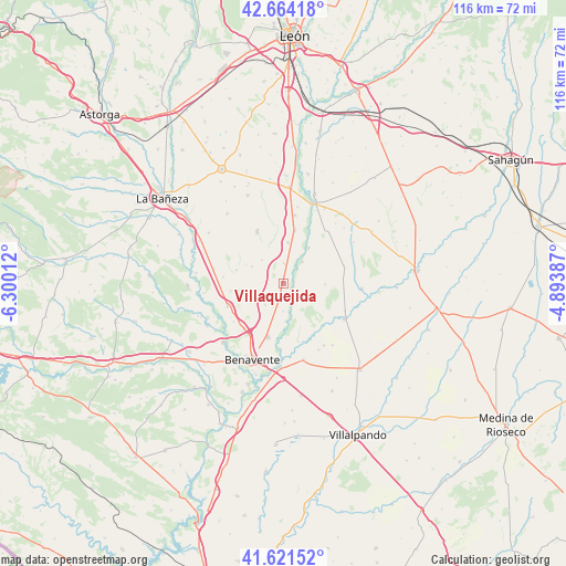
Villaquejida GPS coordinates[2]
42° 8' 42" North, 5° 35' 49.164" West
| Map corner | latitude | longitude |
|---|---|---|
| Upper-left | 42.66418°, | -6.30012° |
| Center: | 42.145°, | -5.59699° |
| Lower-right: | 41.62152°, | -4.89387° |
| Map W x H: | 115.9×115.9 km | = 72×72mi |
| max Lat: | 43.74134° ⇑22.3% North |
| Villaquejida: | 42.145° |
| min Lat: | ⇓77.7% South 27.64134° |
| min Long | Villaquejida | max Long |
| -18.00367° | -5.59699° | 4.2899° |
| W 19.9%⇐ | ⇒80.1% E |
Elevation
Elevation of Villaquejida is 725 m = 2379 ft, and this is 127 m = 417 ft above average elevation for this country.
| Max E: |
1682 m = 5518 ft | 42.8% |
| Villaquejida | 725 m 2379 ft | |
| Avg. | 598 m = 1962 ft | |
Min E: |
0 m = 0 ft | 57.2% |
See also: Spain elevation on elevation.city.
Geographical zone
Villaquejida is located in North temperate zone (between Tropic of Cancer and the Arctic Circle). Distance of this Northern Tropic circle is 2080.2 km =1292.6 mi to South.| Distance of | km | miles | from Villaquejida |
|---|---|---|---|
| North Pole | 5321 | 3306.3 | to North |
| Arctic Circle | 2715.1 | 1687.1 | to North |
| Tropic Cancer | 2080.2 | 1292.6 | to South |
| Equator | 4686.1 | 2911.8 | to South |


Nearby cities:
15 places around Villaquejida: (largest is in red/bold)
• Algadefe
8.3 km =5.2 mi,  7°
7°
• Campazas
8.5 km =5.3 mi,  92°
92°
• Cimanes de la Vega
3.2 km =2 mi,  182°
182°
• Fuentes de Carbajal
13 km =8.1 mi,  73°
73°
• La Antigua
8.5 km =5.3 mi,  296°
296°
• Laguna de Negrillos
11.7 km =7.3 mi,  333°
333°
• Matilla de Arzón
5.8 km =3.6 mi,  219°
219°
• Pobladura del Valle
12.2 km =7.6 mi,  247°
247°
• Pozuelo del Páramo
14.4 km =8.9 mi,  281°
281°
• San Adrián del Valle
11 km =6.8 mi,  261°
261°
• San Cristóbal de Entreviñas
11.5 km =7.1 mi,  195°
195°
• Toral de los Guzmanes
11.1 km =6.9 mi, 12°
• Valderas
14.7 km =9.1 mi,  120°
120°
• Villademor de la Vega
14.1 km =8.8 mi, 9°
• Villamandos
4 km =2.5 mi,  3°
3°
Sources, notices
• [Note1] Compared only with cities in Spain existing in our database
• [Src1] Map data: © OpenStreetMap contributors (CC-BY-SA)
• [Src2] Other city data from geonames.org with taken over terms of usage.
• [Src3] Geographical zone / Annual Mean Temperature by Robert A. Rohde @ Wikipedia
