Villamandos geodata
Villamandos (Castille and León) is a seat of a third-order administrative division; located in Spain in Europe/Madrid (GMT+2) time zone. With population of 356 people, there are 4293 cities with bigger population in this country. Compared to other cities in Spain, 78.8% of cities are located further ↓South; 80.1% of cities are located further →East and 58.3% of cities have lower elevation than Villamandos. Note1
Administrative division(s):
- Level 1: Castille and León
- Level 2: Provincia de León
- Level 3: Villamandos


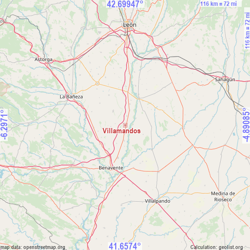
Villamandos GPS coordinates[2]
42° 10' 50.088" North, 5° 35' 38.292" West
| Map corner | latitude | longitude |
|---|---|---|
| Upper-left | 42.69947°, | -6.2971° |
| Center: | 42.18058°, | -5.59397° |
| Lower-right: | 41.6574°, | -4.89085° |
| Map W x H: | 115.9×115.9 km | = 72×72mi |
| max Lat: | 43.74134° ⇑21.2% North |
| Villamandos: | 42.18058° |
| min Lat: | ⇓78.8% South 27.64134° |
| min Long | Villamandos | max Long |
| -18.00367° | -5.59397° | 4.2899° |
| W 19.9%⇐ | ⇒80.1% E |
Elevation
Elevation of Villamandos is 731 m = 2398 ft, and this is 133 m = 436 ft above average elevation for this country.
| Max E: |
1682 m = 5518 ft | 41.7% |
| Villamandos | 731 m 2398 ft | |
| Avg. | 598 m = 1962 ft | |
Min E: |
0 m = 0 ft | 58.3% |
See also: Spain elevation on elevation.city.
Geographical zone
Villamandos is located in North temperate zone (between Tropic of Cancer and the Arctic Circle). Distance of this Northern Tropic circle is 2084.1 km =1295 mi to South.| Distance of | km | miles | from Villamandos |
|---|---|---|---|
| North Pole | 5317 | 3303.8 | to North |
| Arctic Circle | 2711.1 | 1684.6 | to North |
| Tropic Cancer | 2084.1 | 1295 | to South |
| Equator | 4690 | 2914.2 | to South |


Nearby cities:
15 places around Villamandos: (largest is in red/bold)
• Algadefe
4.4 km =2.7 mi,  10°
10°
• Campazas
9.3 km =5.8 mi,  117°
117°
• Cimanes de la Vega
7.1 km =4.4 mi,  183°
183°
• Fuentes de Carbajal
12.2 km =7.6 mi,  91°
91°
• La Antigua
7.9 km =4.9 mi,  268°
268°
• Laguna de Negrillos
8.5 km =5.3 mi,  319°
319°
• Matilla de Arzón
9.3 km =5.8 mi,  205°
205°
• San Adrián del Valle
12.5 km =7.8 mi,  243°
243°
• San Millán de los Caballeros
11.9 km =7.4 mi, 13°
• Toral de los Guzmanes
7.2 km =4.5 mi,  17°
17°
• Valdemora
13.8 km =8.6 mi,  83°
83°
• Valencia de Don Juan
14.1 km =8.8 mi,  26°
26°
• Villabraz
14.2 km =8.8 mi,  58°
58°
• Villademor de la Vega
10.1 km =6.3 mi, 12°
• Villaquejida
4 km =2.5 mi, 183°
Sources, notices
• [Note1] Compared only with cities in Spain existing in our database
• [Src1] Map data: © OpenStreetMap contributors (CC-BY-SA)
• [Src2] Other city data from geonames.org with taken over terms of usage.
• [Src3] Geographical zone / Annual Mean Temperature by Robert A. Rohde @ Wikipedia
