Fuentes de Carbajal geodata
Fuentes de Carbajal (Castille and León) is a seat of a third-order administrative division; located in Spain in Europe/Madrid (GMT+2) time zone. In our database, there are 6762 cities with bigger population. Compared to other cities in Spain, 78.7% of cities are located further ↓South; 78% of cities are located further →East and 69.4% of cities have lower elevation than Fuentes de Carbajal. Note1
Administrative division(s):
- Level 1: Castille and León
- Level 2: Provincia de León
- Level 3: Fuentes de Carbajal


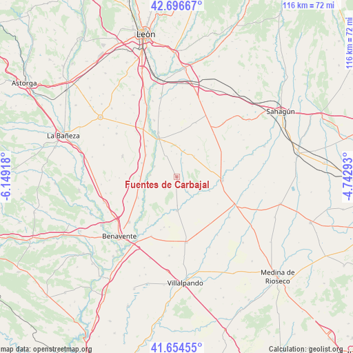
Fuentes de Carbajal GPS coordinates[2]
42° 10' 39.936" North, 5° 26' 45.816" West
| Map corner | latitude | longitude |
|---|---|---|
| Upper-left | 42.69667°, | -6.14918° |
| Center: | 42.17776°, | -5.44606° |
| Lower-right: | 41.65455°, | -4.74293° |
| Map W x H: | 115.9×115.9 km | = 72×72mi |
| max Lat: | 43.74134° ⇑21.3% North |
| Fuentes de Carbajal: | 42.17776° |
| min Lat: | ⇓78.7% South 27.64134° |
| min Long | Fuentes de Carb | max Long |
| -18.00367° | -5.44606° | 4.2899° |
| W 22%⇐ | ⇒78% E |
Elevation
Elevation of Fuentes de Carbajal is 809 m = 2654 ft, and this is 211 m = 692 ft above average elevation for this country.
| Max E: |
1682 m = 5518 ft | 30.6% |
| Fuentes de Carbajal | 809 m 2654 ft | |
| Avg. | 598 m = 1962 ft | |
Min E: |
0 m = 0 ft | 69.4% |
See also: Spain elevation on elevation.city.
Geographical zone
Fuentes de Carbajal is located in North temperate zone (between Tropic of Cancer and the Arctic Circle). Distance of this Northern Tropic circle is 2083.8 km =1294.8 mi to South.| Distance of | km | miles | from Fuentes de Carbajal |
|---|---|---|---|
| North Pole | 5317.3 | 3304 | to North |
| Arctic Circle | 2711.4 | 1684.8 | to North |
| Tropic Cancer | 2083.8 | 1294.8 | to South |
| Equator | 4689.7 | 2914 | to South |


Nearby cities:
15 places around Fuentes de Carbajal: (largest is in red/bold)
• Algadefe
12.3 km =7.6 mi,  292°
292°
• Campazas
5.6 km =3.5 mi,  224°
224°
• Castilfalé
5.1 km =3.2 mi,  23°
23°
• Castrobol
11.8 km =7.3 mi,  112°
112°
• Cimanes de la Vega
14.3 km =8.9 mi,  241°
241°
• Gordoncillo
5.9 km =3.7 mi,  142°
142°
• Mayorga
15.1 km =9.4 mi,  94°
94°
• Toral de los Guzmanes
12.4 km =7.7 mi,  305°
305°
• Valdemora
2.5 km =1.6 mi,  37°
37°
• Valderas
11.1 km =6.9 mi,  178°
178°
• Valencia de Don Juan
14.2 km =8.8 mi,  335°
335°
• Villabraz
7.7 km =4.8 mi,  0°
0°
• Villademor de la Vega
14.3 km =8.9 mi,  315°
315°
• Villamandos
12.2 km =7.6 mi,  271°
271°
• Villaquejida
13 km =8.1 mi,  253°
253°
Sources, notices
• [Note1] Compared only with cities in Spain existing in our database
• [Src1] Map data: © OpenStreetMap contributors (CC-BY-SA)
• [Src2] Other city data from geonames.org with taken over terms of usage.
• [Src3] Geographical zone / Annual Mean Temperature by Robert A. Rohde @ Wikipedia
