Vilanova del Camí geodata
Vilanova del Camí (Catalonia) is a populated place; located in Spain in Europe/Madrid (GMT+2) time zone. With population of 12,649 people, there are 722 cities with bigger population in this country. Compared to other cities in Spain, 62.7% of cities are located further ↓South; 92.1% of cities are located further ←West and 74.2% of cities have higher elevation than Vilanova del Camí. Note1
Administrative division(s):
- Level 1: Catalonia
- Level 2: Província de Barcelona
- Level 3: Santa Margarida de Montbui


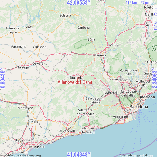
Vilanova del Camí GPS coordinates[2]
41° 34' 17.94" North, 1° 38' 15.036" East
| Map corner | latitude | longitude |
|---|---|---|
| Upper-left | 42.09553°, | 0.93438° |
| Center: | 41.57165°, | 1.63751° |
| Lower-right: | 41.04348°, | 2.34063° |
| Map W x H: | 117×117 km | = 72.7×72.7mi |
| max Lat: | 43.74134° ⇑37.3% North |
| Vilanova del Camí: | 41.57165° |
| min Lat: | ⇓62.7% South 27.64134° |
| min Long | Vilanova del Ca | max Long |
| -18.00367° | 1.63751° | 4.2899° |
| W 92.1%⇐ | ⇒7.9% E |
Elevation
Elevation of Vilanova del Camí is 310 m = 1017 ft, and this is 288 m = 945 ft below average elevation for this country.
| Max E: |
1682 m = 5518 ft | 74.2% |
| Avg. | 598 m = 1962 ft | |
| Vilanova del Camí | 310 m = 1017 ft | |
Min E: |
0 m = 0 ft | 25.8% |
See also: Spain elevation on elevation.city.
Geographical zone
Vilanova del Camí is located in North temperate zone (between Tropic of Cancer and the Arctic Circle). Distance of this Northern Tropic circle is 2016.4 km =1252.9 mi to South.| Distance of | km | miles | from Vilanova del Camí |
|---|---|---|---|
| North Pole | 5384.7 | 3345.9 | to North |
| Arctic Circle | 2778.8 | 1726.7 | to North |
| Tropic Cancer | 2016.4 | 1252.9 | to South |
| Equator | 4622.3 | 2872.2 | to South |


Nearby cities:
15 places around Vilanova del Camí: (largest is in red/bold)
• Capellades
6.2 km =3.9 mi,  138°
138°
• Carme
4.6 km =2.9 mi,  197°
197°
• Castellfollit del Boix
11.8 km =7.3 mi,  26°
26°
• Castellolí
6 km =3.7 mi,  60°
60°
• Igualada
2 km =1.2 mi,  301°
301°
• Jorba
8.2 km =5.1 mi,  294°
294°
• La Llacuna
14.2 km =8.8 mi,  218°
218°
• La Pobla de Claramunt
3.8 km =2.4 mi,  120°
120°
• Mediona
10.6 km =6.6 mi,  191°
191°
• Orpí
7.8 km =4.8 mi, 221°
• Piera
10.9 km =6.8 mi, 120°
• Sant Joan de Mediona
10.6 km =6.6 mi, 191°
• Sant Martí de Tous
10.3 km =6.4 mi,  256°
256°
• Sant Pere de Riudebitlles
14.5 km =9 mi,  158°
158°
• Òdena
3.3 km =2.1 mi,  18°
18°
Sources, notices
• [Note1] Compared only with cities in Spain existing in our database
• [Src1] Map data: © OpenStreetMap contributors (CC-BY-SA)
• [Src2] Other city data from geonames.org with taken over terms of usage.
• [Src3] Geographical zone / Annual Mean Temperature by Robert A. Rohde @ Wikipedia
