Valdastillas geodata
Valdastillas (Extremadura) is a seat of a third-order administrative division; located in Spain in Europe/Madrid (GMT+2) time zone. With population of 317 people, there are 4431 cities with bigger population in this country. Compared to other cities in Spain, 68.2% of cities are located further ↑North; 84.4% of cities are located further →East and 54% of cities have higher elevation than Valdastillas. Note1
Administrative division(s):
- Level 1: Extremadura
- Level 2: Provincia de Cáceres
- Level 3: Valdastillas


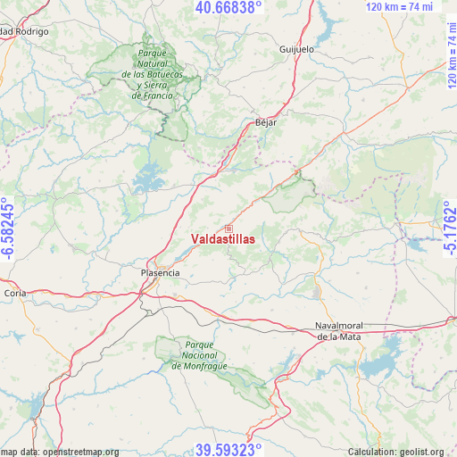
Valdastillas GPS coordinates[2]
40° 7' 58.548" North, 5° 52' 45.552" West
| Map corner | latitude | longitude |
|---|---|---|
| Upper-left | 40.66838°, | -6.58245° |
| Center: | 40.13293°, | -5.87932° |
| Lower-right: | 39.59323°, | -5.1762° |
| Map W x H: | 119.5×119.5 km | = 74.3×74.3mi |
| max Lat: | 43.74134° ⇑68.2% North |
| Valdastillas: | 40.13293° |
| min Lat: | ⇓31.8% South 27.64134° |
| min Long | Valdastillas | max Long |
| -18.00367° | -5.87932° | 4.2899° |
| W 15.6%⇐ | ⇒84.4% E |
Elevation
Elevation of Valdastillas is 612 m = 2008 ft, and this is 14 m = 46 ft above average elevation for this country.
| Max E: |
1682 m = 5518 ft | 54% |
| Valdastillas | 612 m 2008 ft | |
| Avg. | 598 m = 1962 ft | |
Min E: |
0 m = 0 ft | 46% |
See also: Spain elevation on elevation.city.
Geographical zone
Valdastillas is located in North temperate zone (between Tropic of Cancer and the Arctic Circle). Distance of this Northern Tropic circle is 1856.4 km =1153.5 mi to South.| Distance of | km | miles | from Valdastillas |
|---|---|---|---|
| North Pole | 5544.7 | 3445.3 | to North |
| Arctic Circle | 2938.8 | 1826.1 | to North |
| Tropic Cancer | 1856.4 | 1153.5 | to South |
| Equator | 4462.4 | 2772.8 | to South |


Nearby cities:
15 places around Valdastillas: (largest is in red/bold)
• Arroyomolinos de la Vera
9.2 km =5.7 mi,  164°
164°
• Barrado
5.4 km =3.4 mi,  181°
181°
• Cabezabellosa
10.3 km =6.4 mi,  272°
272°
• Cabezuela del Valle
9.2 km =5.7 mi,  42°
42°
• Cabrero
2.5 km =1.6 mi,  207°
207°
• Casas del Castañar
3.5 km =2.2 mi,  218°
218°
• Casas del Monte
10.5 km =6.5 mi,  318°
318°
• El Torno
5.5 km =3.4 mi, 273°
• Garganta la Olla
9.1 km =5.7 mi,  105°
105°
• Gargüera
9 km =5.6 mi, 207°
• Jarilla
11.3 km =7 mi,  292°
292°
• Navaconcejo
6.4 km =4 mi, 39°
• Piornal
3.2 km =2 mi,  123°
123°
• Segura de Toro
11.7 km =7.3 mi,  329°
329°
• Villar de Plasencia
12.6 km =7.8 mi, 272°
Sources, notices
• [Note1] Compared only with cities in Spain existing in our database
• [Src1] Map data: © OpenStreetMap contributors (CC-BY-SA)
• [Src2] Other city data from geonames.org with taken over terms of usage.
• [Src3] Geographical zone / Annual Mean Temperature by Robert A. Rohde @ Wikipedia
