Casas del Castañar geodata
Casas del Castañar (Extremadura) is a seat of a third-order administrative division; located in Spain in Europe/Madrid (GMT+2) time zone. With population of 661 people, there are 3482 cities with bigger population in this country. Compared to other cities in Spain, 68.6% of cities are located further ↑North; 84.8% of cities are located further →East and 52% of cities have lower elevation than Casas del Castañar. Note1
Administrative division(s):
- Level 1: Extremadura
- Level 2: Provincia de Cáceres
- Level 3: Casas del Castañar


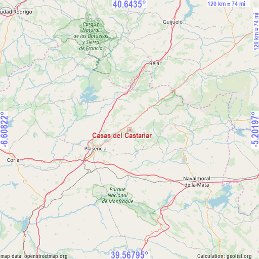
Casas del Castañar GPS coordinates[2]
40° 6' 28.26" North, 5° 54' 18.324" West
| Map corner | latitude | longitude |
|---|---|---|
| Upper-left | 40.6435°, | -6.60822° |
| Center: | 40.10785°, | -5.90509° |
| Lower-right: | 39.56795°, | -5.20197° |
| Map W x H: | 119.6×119.6 km | = 74.3×74.3mi |
| max Lat: | 43.74134° ⇑68.6% North |
| Casas del Castañar: | 40.10785° |
| min Lat: | ⇓31.4% South 27.64134° |
| min Long | Casas del Casta | max Long |
| -18.00367° | -5.90509° | 4.2899° |
| W 15.2%⇐ | ⇒84.8% E |
Elevation
Elevation of Casas del Castañar is 680 m = 2231 ft, and this is 82 m = 269 ft above average elevation for this country.
| Max E: |
1682 m = 5518 ft | 48% |
| Casas del Castañar | 680 m 2231 ft | |
| Avg. | 598 m = 1962 ft | |
Min E: |
0 m = 0 ft | 52% |
See also: Spain elevation on elevation.city.
Geographical zone
Casas del Castañar is located in North temperate zone (between Tropic of Cancer and the Arctic Circle). Distance of this Northern Tropic circle is 1853.7 km =1151.8 mi to South.| Distance of | km | miles | from Casas del Castañar |
|---|---|---|---|
| North Pole | 5547.5 | 3447.1 | to North |
| Arctic Circle | 2941.6 | 1827.8 | to North |
| Tropic Cancer | 1853.7 | 1151.8 | to South |
| Equator | 4459.6 | 2771.1 | to South |


Nearby cities:
15 places around Casas del Castañar: (largest is in red/bold)
• Arroyomolinos de la Vera
7.7 km =4.8 mi,  143°
143°
• Barrado
3.3 km =2.1 mi, 141°
• Cabezabellosa
8.8 km =5.5 mi,  292°
292°
• Cabezuela del Valle
12.7 km =7.9 mi,  41°
41°
• Cabrero
1.2 km =0.7 mi,  59°
59°
• Casas del Monte
11.6 km =7.2 mi,  335°
335°
• El Torno
4.6 km =2.9 mi,  313°
313°
• Garganta la Olla
10.9 km =6.8 mi,  88°
88°
• Gargüera
5.5 km =3.4 mi,  200°
200°
• Jarilla
10.9 km =6.8 mi, 310°
• Navaconcejo
9.9 km =6.2 mi, 39°
• Piornal
5 km =3.1 mi,  77°
77°
• Tejeda de Tiétar
10.4 km =6.5 mi,  163°
163°
• Valdastillas
3.5 km =2.2 mi, 38°
• Villar de Plasencia
11 km =6.8 mi, 287°
Sources, notices
• [Note1] Compared only with cities in Spain existing in our database
• [Src1] Map data: © OpenStreetMap contributors (CC-BY-SA)
• [Src2] Other city data from geonames.org with taken over terms of usage.
• [Src3] Geographical zone / Annual Mean Temperature by Robert A. Rohde @ Wikipedia
