Navaconcejo geodata
Navaconcejo (Extremadura) is a seat of a third-order administrative division; located in Spain in Europe/Madrid (GMT+2) time zone. With population of 2,121 people, there are 2087 cities with bigger population in this country. Compared to other cities in Spain, 67.6% of cities are located further ↑North; 83.7% of cities are located further →East and 64.9% of cities have higher elevation than Navaconcejo. Note1


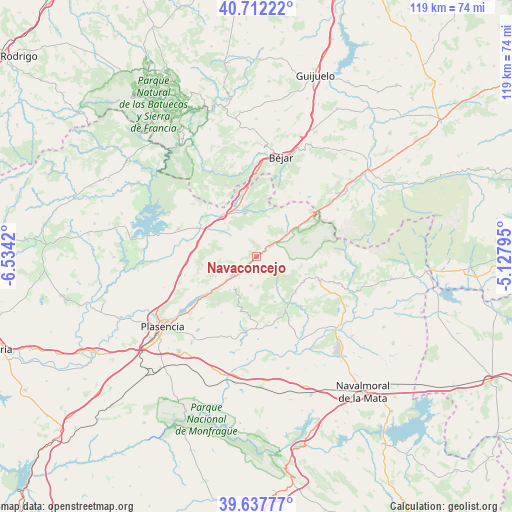
Navaconcejo GPS coordinates[2]
40° 10' 37.632" North, 5° 49' 51.888" West
| Map corner | latitude | longitude |
|---|---|---|
| Upper-left | 40.71222°, | -6.5342° |
| Center: | 40.17712°, | -5.83108° |
| Lower-right: | 39.63777°, | -5.12795° |
| Map W x H: | 119.5×119.5 km | = 74.3×74.3mi |
| max Lat: | 43.74134° ⇑67.6% North |
| Navaconcejo: | 40.17712° |
| min Lat: | ⇓32.4% South 27.64134° |
| min Long | Navaconcejo | max Long |
| -18.00367° | -5.83108° | 4.2899° |
| W 16.3%⇐ | ⇒83.7% E |
Elevation
Elevation of Navaconcejo is 462 m = 1516 ft, and this is 136 m = 446 ft below average elevation for this country.
| Max E: |
1682 m = 5518 ft | 64.9% |
| Avg. | 598 m = 1962 ft | |
| Navaconcejo | 462 m = 1516 ft | |
Min E: |
0 m = 0 ft | 35.1% |
See also: Spain elevation on elevation.city.
Geographical zone
Navaconcejo is located in North temperate zone (between Tropic of Cancer and the Arctic Circle). Distance of this Northern Tropic circle is 1861.4 km =1156.6 mi to South.| Distance of | km | miles | from Navaconcejo |
|---|---|---|---|
| North Pole | 5539.8 | 3442.3 | to North |
| Arctic Circle | 2933.9 | 1823 | to North |
| Tropic Cancer | 1861.4 | 1156.6 | to South |
| Equator | 4467.3 | 2775.9 | to South |


Nearby cities:
15 places around Navaconcejo: (largest is in red/bold)
• Aldeanueva de la Vera
12.3 km =7.6 mi,  116°
116°
• Barrado
11.1 km =6.9 mi,  202°
202°
• Cabezuela del Valle
2.8 km =1.7 mi,  48°
48°
• Cabrero
8.8 km =5.5 mi,  216°
216°
• Casas del Castañar
9.9 km =6.2 mi, 219°
• Casas del Monte
11.5 km =7.1 mi,  284°
284°
• Cuacos
12.1 km =7.5 mi,  131°
131°
• El Torno
10.6 km =6.6 mi,  244°
244°
• Garganta la Olla
8.7 km =5.4 mi,  148°
148°
• Gargantilla
11 km =6.8 mi,  316°
316°
• Hervás
10.9 km =6.8 mi,  343°
343°
• Jerte
8.5 km =5.3 mi, 53°
• Piornal
6.8 km =4.2 mi,  192°
192°
• Segura de Toro
11.3 km =7 mi,  297°
297°
• Valdastillas
6.4 km =4 mi, 219°
Sources, notices
• [Note1] Compared only with cities in Spain existing in our database
• [Src1] Map data: © OpenStreetMap contributors (CC-BY-SA)
• [Src2] Other city data from geonames.org with taken over terms of usage.
• [Src3] Geographical zone / Annual Mean Temperature by Robert A. Rohde @ Wikipedia
