Truchas geodata
Truchas (Castille and León) is a seat of a third-order administrative division; located in Spain in Europe/Madrid (GMT+2) time zone. With population of 647 people, there are 3507 cities with bigger population in this country. Compared to other cities in Spain, 80.9% of cities are located further ↓South; 90.7% of cities are located further →East and 94.2% of cities have lower elevation than Truchas. Note1


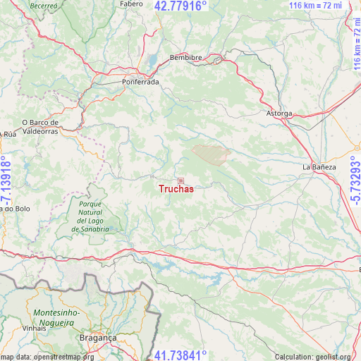
Truchas GPS coordinates[2]
42° 15' 39.348" North, 6° 26' 9.78" West
| Map corner | latitude | longitude |
|---|---|---|
| Upper-left | 42.77916°, | -7.13918° |
| Center: | 42.26093°, | -6.43605° |
| Lower-right: | 41.73841°, | -5.73293° |
| Map W x H: | 115.7×115.7 km | = 71.9×71.9mi |
| max Lat: | 43.74134° ⇑19.1% North |
| Truchas: | 42.26093° |
| min Lat: | ⇓80.9% South 27.64134° |
| min Long | Truchas | max Long |
| -18.00367° | -6.43605° | 4.2899° |
| W 9.3%⇐ | ⇒90.7% E |
Elevation
Elevation of Truchas is 1121 m = 3678 ft, and this is 523 m = 1716 ft above average elevation for this country.
| Max E: |
1682 m = 5518 ft | 5.8% |
| Truchas | 1121 m 3678 ft | |
| Avg. | 598 m = 1962 ft | |
Min E: |
0 m = 0 ft | 94.2% |
See also: Spain elevation on elevation.city.
Geographical zone
Truchas is located in North temperate zone (between Tropic of Cancer and the Arctic Circle). Distance of this Northern Tropic circle is 2093.1 km =1300.6 mi to South.| Distance of | km | miles | from Truchas |
|---|---|---|---|
| North Pole | 5308.1 | 3298.3 | to North |
| Arctic Circle | 2702.2 | 1679.1 | to North |
| Tropic Cancer | 2093.1 | 1300.6 | to South |
| Equator | 4699 | 2919.8 | to South |


Nearby cities:
15 places around Truchas: (largest is in red/bold)
• Asturianos
23.6 km =14.7 mi,  190°
190°
• Castrillo de Cabrera
12.6 km =7.8 mi,  314°
314°
• Castrocontrigo
22 km =13.7 mi,  113°
113°
• Encinedo
13 km =8.1 mi,  274°
274°
• Espadañedo
16.5 km =10.3 mi,  167°
167°
• Galende
25.5 km =15.8 mi,  226°
226°
• Justel
17 km =10.6 mi,  137°
137°
• Luyego
20.4 km =12.7 mi,  54°
54°
• Manzanal de los Infantes
23.4 km =14.5 mi, 169°
• Muelas de los Caballeros
16.8 km =10.4 mi,  151°
151°
• Palacios de Sanabria
23.6 km =14.7 mi,  197°
197°
• Peque
24.8 km =15.4 mi, 147°
• Robleda-Cervantes
23.7 km =14.7 mi,  213°
213°
• San Justo
21 km =13 mi, 227°
• Trefacio
23.7 km =14.7 mi, 229°
Sources, notices
• [Note1] Compared only with cities in Spain existing in our database
• [Src1] Map data: © OpenStreetMap contributors (CC-BY-SA)
• [Src2] Other city data from geonames.org with taken over terms of usage.
• [Src3] Geographical zone / Annual Mean Temperature by Robert A. Rohde @ Wikipedia
