Manzanal de los Infantes geodata
Manzanal de los Infantes (Castille and León) is a seat of a third-order administrative division; located in Spain in Europe/Madrid (GMT+2) time zone. With population of 178 people, there are 5195 cities with bigger population in this country. Compared to other cities in Spain, 75.3% of cities are located further ↓South; 90.2% of cities are located further →East and 82.3% of cities have lower elevation than Manzanal de los Infantes. Note1
Administrative division(s):
- Level 1: Castille and León
- Level 2: Provincia de Zamora
- Level 3: Manzanal de los Infantes
Current local time in Manzanal de los Infantes:
12:01 AM, FridayDifference from your time zone: hours


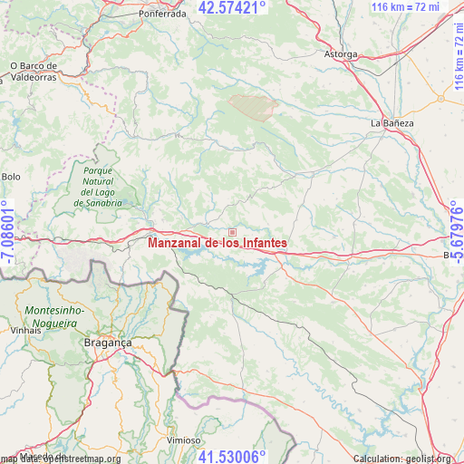
Manzanal de los Infantes GPS coordinates[2]
42° 3' 15.408" North, 6° 22' 58.368" West
| Map corner | latitude | longitude |
|---|---|---|
| Upper-left | 42.57421°, | -7.08601° |
| Center: | 42.05428°, | -6.38288° |
| Lower-right: | 41.53006°, | -5.67976° |
| Map W x H: | 116.1×116.1 km | = 72.1×72.1mi |
| max Lat: | 43.74134° ⇑24.7% North |
| Manzanal de los Infantes: | 42.05428° |
| min Lat: | ⇓75.3% South 27.64134° |
| min Long | Manzanal de los | max Long |
| -18.00367° | -6.38288° | 4.2899° |
| W 9.8%⇐ | ⇒90.2% E |
Elevation
Elevation of Manzanal de los Infantes is 920 m = 3018 ft, and this is 322 m = 1056 ft above average elevation for this country.
| Max E: |
1682 m = 5518 ft | 17.7% |
| Manzanal de los Infantes | 920 m 3018 ft | |
| Avg. | 598 m = 1962 ft | |
Min E: |
0 m = 0 ft | 82.3% |
See also: Spain elevation on elevation.city.
Geographical zone
Manzanal de los Infantes is located in North temperate zone (between Tropic of Cancer and the Arctic Circle). Distance of this Northern Tropic circle is 2070.1 km =1286.3 mi to South.| Distance of | km | miles | from Manzanal de los Infantes |
|---|---|---|---|
| North Pole | 5331.1 | 3312.6 | to North |
| Arctic Circle | 2725.2 | 1693.4 | to North |
| Tropic Cancer | 2070.1 | 1286.3 | to South |
| Equator | 4676 | 2905.5 | to South |


Nearby cities:
15 places around Manzanal de los Infantes: (largest is in red/bold)
• Asturianos
8.8 km =5.5 mi,  268°
268°
• Cernadilla
4.7 km =2.9 mi,  217°
217°
• Cubo de Benavente
19.7 km =12.2 mi,  66°
66°
• Espadañedo
6.9 km =4.3 mi,  352°
352°
• Justel
12.7 km =7.9 mi,  34°
34°
• Mahide
20.6 km =12.8 mi,  178°
178°
• Manzanal de Arriba
8.4 km =5.2 mi,  214°
214°
• Molezuelas de la Carballeda
16.4 km =10.2 mi,  79°
79°
• Mombuey
5.6 km =3.5 mi,  128°
128°
• Muelas de los Caballeros
9.1 km =5.7 mi,  24°
24°
• Palacios de Sanabria
11.6 km =7.2 mi, 272°
• Peque
9.2 km =5.7 mi, 76°
• Robleda-Cervantes
17.7 km =11 mi,  280°
280°
• Uña de Quintana
20 km =12.4 mi, 79°
• Villardeciervos
14.8 km =9.2 mi,  147°
147°
Sources, notices
• [Note1] Compared only with cities in Spain existing in our database
• [Src1] Map data: © OpenStreetMap contributors (CC-BY-SA)
• [Src2] Other city data from geonames.org with taken over terms of usage.
• [Src3] Geographical zone / Annual Mean Temperature by Robert A. Rohde @ Wikipedia
