Asturianos geodata
Asturianos (Castille and León) is a seat of a third-order administrative division; located in Spain in Europe/Madrid (GMT+2) time zone. With population of 327 people, there are 4397 cities with bigger population in this country. Compared to other cities in Spain, 75.2% of cities are located further ↓South; 91.1% of cities are located further →East and 86.4% of cities have lower elevation than Asturianos. Note1
Administrative division(s):
- Level 1: Castille and León
- Level 2: Provincia de Zamora
- Level 3: Asturianos


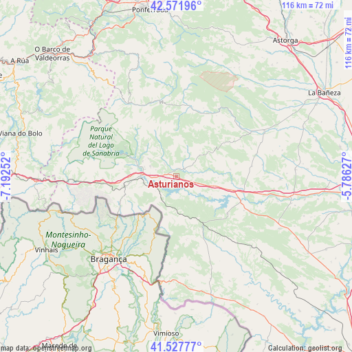
Asturianos GPS coordinates[2]
42° 3' 7.236" North, 6° 29' 21.84" West
| Map corner | latitude | longitude |
|---|---|---|
| Upper-left | 42.57196°, | -7.19252° |
| Center: | 42.05201°, | -6.4894° |
| Lower-right: | 41.52777°, | -5.78627° |
| Map W x H: | 116.1×116.1 km | = 72.1×72.1mi |
| max Lat: | 43.74134° ⇑24.8% North |
| Asturianos: | 42.05201° |
| min Lat: | ⇓75.2% South 27.64134° |
| min Long | Asturianos | max Long |
| -18.00367° | -6.4894° | 4.2899° |
| W 8.9%⇐ | ⇒91.1% E |
Elevation
Elevation of Asturianos is 970 m = 3182 ft, and this is 372 m = 1220 ft above average elevation for this country.
| Max E: |
1682 m = 5518 ft | 13.6% |
| Asturianos | 970 m 3182 ft | |
| Avg. | 598 m = 1962 ft | |
Min E: |
0 m = 0 ft | 86.4% |
See also: Spain elevation on elevation.city.
Geographical zone
Asturianos is located in North temperate zone (between Tropic of Cancer and the Arctic Circle). Distance of this Northern Tropic circle is 2069.8 km =1286.1 mi to South.| Distance of | km | miles | from Asturianos |
|---|---|---|---|
| North Pole | 5331.3 | 3312.7 | to North |
| Arctic Circle | 2725.4 | 1693.5 | to North |
| Tropic Cancer | 2069.8 | 1286.1 | to South |
| Equator | 4675.7 | 2905.3 | to South |


Nearby cities:
15 places around Asturianos: (largest is in red/bold)
• Cernadilla
6.9 km =4.3 mi,  120°
120°
• Cobreros
17.6 km =10.9 mi,  277°
277°
• Espadañedo
10.6 km =6.6 mi,  47°
47°
• Galende
15.4 km =9.6 mi,  292°
292°
• Justel
19.2 km =11.9 mi,  56°
56°
• Manzanal de Arriba
7.8 km =4.8 mi,  148°
148°
• Manzanal de los Infantes
8.8 km =5.5 mi,  88°
88°
• Mombuey
13.5 km =8.4 mi,  103°
103°
• Muelas de los Caballeros
15.2 km =9.4 mi, 55°
• Palacios de Sanabria
2.9 km =1.8 mi, 285°
• Peque
17.9 km =11.1 mi,  82°
82°
• Puebla de Sanabria
11.9 km =7.4 mi,  271°
271°
• Robleda-Cervantes
9.3 km =5.8 mi, 291°
• San Justo
14.3 km =8.9 mi,  309°
309°
• Trefacio
15.6 km =9.7 mi,  299°
299°
Sources, notices
• [Note1] Compared only with cities in Spain existing in our database
• [Src1] Map data: © OpenStreetMap contributors (CC-BY-SA)
• [Src2] Other city data from geonames.org with taken over terms of usage.
• [Src3] Geographical zone / Annual Mean Temperature by Robert A. Rohde @ Wikipedia
