Tramacastiel geodata
Tramacastiel (Aragon) is a seat of a third-order administrative division; located in Spain in Europe/Madrid (GMT+2) time zone. With population of 115 people, there are 5757 cities with bigger population in this country. Compared to other cities in Spain, 67.4% of cities are located further ↑North; 75.3% of cities are located further ←West and 78.8% of cities have lower elevation than Tramacastiel. Note1


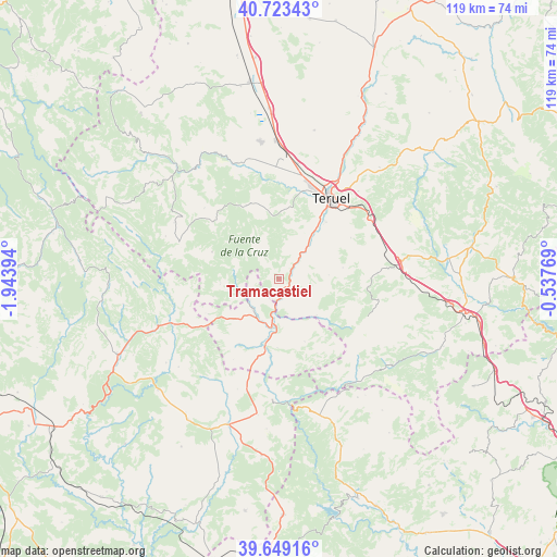
Tramacastiel GPS coordinates[2]
40° 11' 18.312" North, 1° 14' 26.916" West
| Map corner | latitude | longitude |
|---|---|---|
| Upper-left | 40.72343°, | -1.94394° |
| Center: | 40.18842°, | -1.24081° |
| Lower-right: | 39.64916°, | -0.53769° |
| Map W x H: | 119.4×119.4 km | = 74.2×74.2mi |
| max Lat: | 43.74134° ⇑67.4% North |
| Tramacastiel: | 40.18842° |
| min Lat: | ⇓32.6% South 27.64134° |
| min Long | Tramacastiel | max Long |
| -18.00367° | -1.24081° | 4.2899° |
| W 75.3%⇐ | ⇒24.7% E |
Elevation
Elevation of Tramacastiel is 886 m = 2907 ft, and this is 288 m = 945 ft above average elevation for this country.
| Max E: |
1682 m = 5518 ft | 21.2% |
| Tramacastiel | 886 m 2907 ft | |
| Avg. | 598 m = 1962 ft | |
Min E: |
0 m = 0 ft | 78.8% |
See also: Spain elevation on elevation.city.
Geographical zone
Tramacastiel is located in North temperate zone (between Tropic of Cancer and the Arctic Circle). Distance of this Northern Tropic circle is 1862.6 km =1157.4 mi to South.| Distance of | km | miles | from Tramacastiel |
|---|---|---|---|
| North Pole | 5538.5 | 3441.5 | to North |
| Arctic Circle | 2932.6 | 1822.2 | to North |
| Tropic Cancer | 1862.6 | 1157.4 | to South |
| Equator | 4468.5 | 2776.6 | to South |


Nearby cities:
15 places around Tramacastiel: (largest is in red/bold)
• Ademuz
14.7 km =9.1 mi,  195°
195°
• Alobras
12.5 km =7.8 mi,  266°
266°
• Cascante del Río
10.8 km =6.7 mi,  85°
85°
• Castielfabib
8.4 km =5.2 mi,  219°
219°
• Cubla
13.9 km =8.6 mi,  80°
80°
• Jabaloyas
15.4 km =9.6 mi,  291°
291°
• Libros
2.9 km =1.8 mi,  167°
167°
• Riodeva
11.1 km =6.9 mi,  135°
135°
• Rubiales
10.1 km =6.3 mi,  344°
344°
• Tormón
9.7 km =6 mi,  279°
279°
• Valacloche
12.7 km =7.9 mi, 88°
• Vallanca
15.7 km =9.8 mi,  210°
210°
• Veguillas de la Sierra
14.2 km =8.8 mi,  252°
252°
• Villastar
12.8 km =8 mi,  36°
36°
• Villel
6.9 km =4.3 mi, 42°
Sources, notices
• [Note1] Compared only with cities in Spain existing in our database
• [Src1] Map data: © OpenStreetMap contributors (CC-BY-SA)
• [Src2] Other city data from geonames.org with taken over terms of usage.
• [Src3] Geographical zone / Annual Mean Temperature by Robert A. Rohde @ Wikipedia
