Langayo geodata
Langayo (Castille and León) is a seat of a third-order administrative division; located in Spain in Europe/Madrid (GMT+2) time zone. With population of 392 people, there are 4164 cities with bigger population in this country. Compared to other cities in Spain, 62.6% of cities are located further ↓South; 62.6% of cities are located further →East and 71.3% of cities have lower elevation than Langayo. Note1
Administrative division(s):
- Level 1: Castille and León
- Level 2: Provincia de Valladolid
- Level 3: Langayo


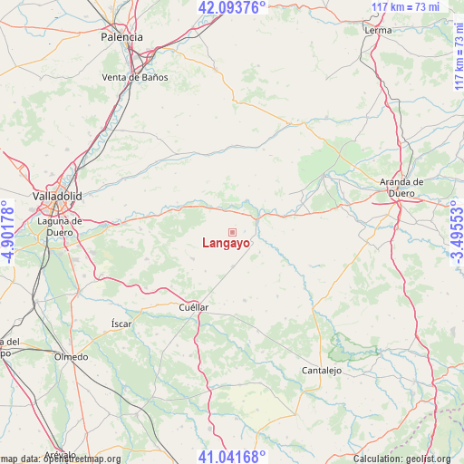
Langayo GPS coordinates[2]
41° 34' 11.496" North, 4° 11' 55.176" West
| Map corner | latitude | longitude |
|---|---|---|
| Upper-left | 42.09376°, | -4.90178° |
| Center: | 41.56986°, | -4.19866° |
| Lower-right: | 41.04168°, | -3.49553° |
| Map W x H: | 117×117 km | = 72.7×72.7mi |
| max Lat: | 43.74134° ⇑37.4% North |
| Langayo: | 41.56986° |
| min Lat: | ⇓62.6% South 27.64134° |
| min Long | Langayo | max Long |
| -18.00367° | -4.19866° | 4.2899° |
| W 37.4%⇐ | ⇒62.6% E |
Elevation
Elevation of Langayo is 823 m = 2700 ft, and this is 225 m = 738 ft above average elevation for this country.
| Max E: |
1682 m = 5518 ft | 28.7% |
| Langayo | 823 m 2700 ft | |
| Avg. | 598 m = 1962 ft | |
Min E: |
0 m = 0 ft | 71.3% |
See also: Spain elevation on elevation.city.
Geographical zone
Langayo is located in North temperate zone (between Tropic of Cancer and the Arctic Circle). Distance of this Northern Tropic circle is 2016.2 km =1252.8 mi to South.| Distance of | km | miles | from Langayo |
|---|---|---|---|
| North Pole | 5384.9 | 3346 | to North |
| Arctic Circle | 2779 | 1726.8 | to North |
| Tropic Cancer | 2016.2 | 1252.8 | to South |
| Equator | 4622.1 | 2872 | to South |


Nearby cities:
15 places around Langayo: (largest is in red/bold)
• Bahabón
11.9 km =7.4 mi,  214°
214°
• Bocos de Duero
12.2 km =7.6 mi,  60°
60°
• Campaspero
8.7 km =5.4 mi,  178°
178°
• Canalejas de Peñafiel
8.5 km =5.3 mi,  125°
125°
• Cogeces del Monte
11.9 km =7.4 mi,  236°
236°
• Curiel de Duero
11.5 km =7.1 mi,  44°
44°
• Fompedraza
5.9 km =3.7 mi, 130°
• Manzanillo
2 km =1.2 mi,  25°
25°
• Pesquera de Duero
8.7 km =5.4 mi,  23°
23°
• Peñafiel
7.9 km =4.9 mi, 63°
• Piñel de Abajo
12.4 km =7.7 mi, 20°
• Quintanilla de Arriba
5.8 km =3.6 mi,  344°
344°
• Rábano
12.1 km =7.5 mi,  109°
109°
• Torre de Peñafiel
9.9 km =6.2 mi, 112°
• Valbuena de Duero
11.3 km =7 mi,  316°
316°
Sources, notices
• [Note1] Compared only with cities in Spain existing in our database
• [Src1] Map data: © OpenStreetMap contributors (CC-BY-SA)
• [Src2] Other city data from geonames.org with taken over terms of usage.
• [Src3] Geographical zone / Annual Mean Temperature by Robert A. Rohde @ Wikipedia
