Castellfollit de la Roca geodata
Castellfollit de la Roca (Catalonia) is a populated place; located in Spain in Europe/Madrid (GMT+2) time zone. With population of 964 people, there are 2994 cities with bigger population in this country. Compared to other cities in Spain, 79.8% of cities are located further ↓South; 96.7% of cities are located further ←West and 74.6% of cities have higher elevation than Castellfollit de la Roca. Note1
Administrative division(s):
- Level 1: Catalonia
- Level 2: Província de Girona
- Level 3: Castellfollit de la Roca
Current local time in Castellfollit de la Roca:
10:46 PM, ThursdayDifference from your time zone: hours


Castellfollit de la Roca GPS coordinates[2]
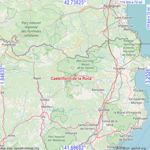
42° 13' 10.848" North, 2° 32' 58.092" East
| Map corner | latitude | longitude |
|---|---|---|
| Upper-left | 42.73825°, | 1.84635° |
| Center: | 42.21968°, | 2.54947° |
| Lower-right: | 41.69682°, | 3.2526° |
| Map W x H: | 115.8×115.8 km | = 72×72mi |
| max Lat: | 43.74134° ⇑20.2% North |
| Castellfollit de la Roca: | 42.21968° |
| min Lat: | ⇓79.8% South 27.64134° |
| min Long | Castellfollit d | max Long |
| -18.00367° | 2.54947° | 4.2899° |
| W 96.7%⇐ | ⇒3.3% E |
Elevation
Elevation of Castellfollit de la Roca is 302 m = 991 ft, and this is 296 m = 971 ft below average elevation for this country.
| Max E: |
1682 m = 5518 ft | 74.6% |
| Avg. | 598 m = 1962 ft | |
| Castellfollit de la Roca | 302 m = 991 ft | |
Min E: |
0 m = 0 ft | 25.4% |
See also: Spain elevation on elevation.city.
Geographical zone
Castellfollit de la Roca is located in North temperate zone (between Tropic of Cancer and the Arctic Circle). Distance of this Northern Tropic circle is 2088.5 km =1297.7 mi to South.| Distance of | km | miles | from Castellfollit de la Roca |
|---|---|---|---|
| North Pole | 5312.7 | 3301.2 | to North |
| Arctic Circle | 2706.8 | 1681.9 | to North |
| Tropic Cancer | 2088.5 | 1297.7 | to South |
| Equator | 4694.4 | 2917 | to South |


Nearby cities:
15 places around Castellfollit de la Roca: (largest is in red/bold)
• Argelaguer
7.6 km =4.7 mi,  93°
93°
• Besalú
12.6 km =7.8 mi,  100°
100°
• Beuda
13.3 km =8.3 mi,  81°
81°
• Mieres
13.1 km =8.1 mi,  145°
145°
• Montagut
4 km =2.5 mi,  73°
73°
• Olot
6.5 km =4 mi,  228°
228°
• Sales de Llierca
8.4 km =5.2 mi, 79°
• Sant Cristòfol de les Fonts
6.9 km =4.3 mi,  216°
216°
• Sant Ferriol
9.9 km =6.2 mi, 102°
• Sant Jaume de Llierca
5.5 km =3.4 mi, 93°
• Sant Joan les Fonts
3.1 km =1.9 mi,  253°
253°
• Santa Pau
8.6 km =5.3 mi,  167°
167°
• Tortellà
7.1 km =4.4 mi, 77°
• la Canya
4.6 km =2.9 mi, 249°
• les Preses
11.1 km =6.9 mi, 221°
Sources, notices
• [Note1] Compared only with cities in Spain existing in our database
• [Src1] Map data: © OpenStreetMap contributors (CC-BY-SA)
• [Src2] Other city data from geonames.org with taken over terms of usage.
• [Src3] Geographical zone / Annual Mean Temperature by Robert A. Rohde @ Wikipedia
