San Andrés del Rey geodata
San Andrés del Rey (Castille-La Mancha) is a seat of a third-order administrative division; located in Spain in Europe/Madrid (GMT+2) time zone. With population of 46 people, there are 6506 cities with bigger population in this country. Compared to other cities in Spain, 59% of cities are located further ↑North; 57.1% of cities are located further ←West and 89.5% of cities have lower elevation than San Andrés del Rey. Note1
Administrative division(s):
- Level 1: Castille-La Mancha
- Level 2: Provincia de Guadalajara
- Level 3: San Andrés del Rey


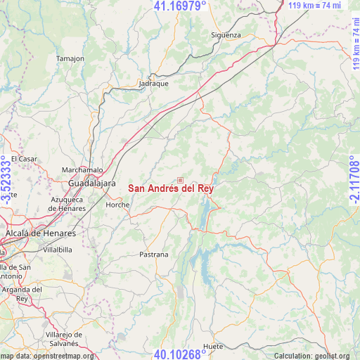
San Andrés del Rey GPS coordinates[2]
40° 38' 18.132" North, 2° 49' 12.72" West
| Map corner | latitude | longitude |
|---|---|---|
| Upper-left | 41.16979°, | -3.52333° |
| Center: | 40.63837°, | -2.8202° |
| Lower-right: | 40.10268°, | -2.11708° |
| Map W x H: | 118.7×118.7 km | = 73.8×73.8mi |
| max Lat: | 43.74134° ⇑59% North |
| San Andrés del Rey: | 40.63837° |
| min Lat: | ⇓41% South 27.64134° |
| min Long | San Andrés del | max Long |
| -18.00367° | -2.8202° | 4.2899° |
| W 57.1%⇐ | ⇒42.9% E |
Elevation
Elevation of San Andrés del Rey is 1022 m = 3353 ft, and this is 424 m = 1391 ft above average elevation for this country.
| Max E: |
1682 m = 5518 ft | 10.5% |
| San Andrés del Rey | 1022 m 3353 ft | |
| Avg. | 598 m = 1962 ft | |
Min E: |
0 m = 0 ft | 89.5% |
See also: Spain elevation on elevation.city.
Geographical zone
San Andrés del Rey is located in North temperate zone (between Tropic of Cancer and the Arctic Circle). Distance of this Northern Tropic circle is 1912.6 km =1188.4 mi to South.| Distance of | km | miles | from San Andrés del Rey |
|---|---|---|---|
| North Pole | 5488.5 | 3410.4 | to North |
| Arctic Circle | 2882.6 | 1791.2 | to North |
| Tropic Cancer | 1912.6 | 1188.4 | to South |
| Equator | 4518.6 | 2807.7 | to South |


Nearby cities:
15 places around San Andrés del Rey: (largest is in red/bold)
• Alhóndiga
12.4 km =7.7 mi,  181°
181°
• Alocén
9.2 km =5.7 mi,  140°
140°
• Auñón
13.6 km =8.5 mi,  170°
170°
• Berninches
7.7 km =4.8 mi, 167°
• Budia
5.4 km =3.4 mi,  103°
103°
• Chillarón del Rey
11.8 km =7.3 mi,  112°
112°
• Durón
8 km =5 mi, 100°
• Henche
12.7 km =7.9 mi,  48°
48°
• Irueste
6.6 km =4.1 mi,  243°
243°
• Mantiel
13.4 km =8.3 mi, 99°
• Peñalver
8.6 km =5.3 mi,  222°
222°
• Valdeavellano
13 km =8.1 mi,  283°
283°
• Valfermoso de Tajuña
11.5 km =7.1 mi,  259°
259°
• Yélamos de Abajo
3.3 km =2.1 mi, 255°
• Yélamos de Arriba
2 km =1.2 mi, 275°
Sources, notices
• [Note1] Compared only with cities in Spain existing in our database
• [Src1] Map data: © OpenStreetMap contributors (CC-BY-SA)
• [Src2] Other city data from geonames.org with taken over terms of usage.
• [Src3] Geographical zone / Annual Mean Temperature by Robert A. Rohde @ Wikipedia
