Berninches geodata
Berninches (Castille-La Mancha) is a seat of a third-order administrative division; located in Spain in Europe/Madrid (GMT+2) time zone. With population of 122 people, there are 5674 cities with bigger population in this country. Compared to other cities in Spain, 60.4% of cities are located further ↑North; 57.4% of cities are located further ←West and 83.1% of cities have lower elevation than Berninches. Note1
Administrative division(s):
- Level 1: Castille-La Mancha
- Level 2: Provincia de Guadalajara
- Level 3: Berninches


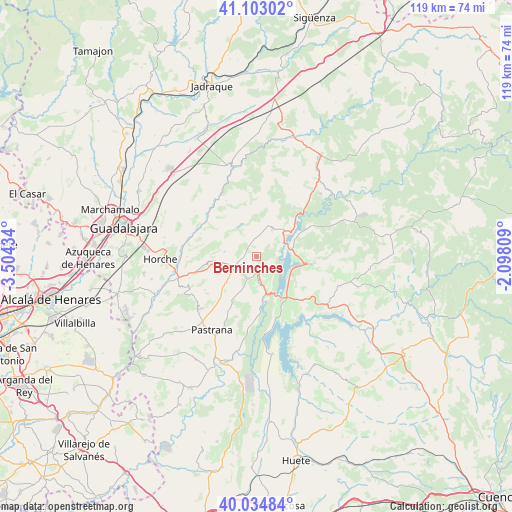
Berninches GPS coordinates[2]
40° 34' 15.816" North, 2° 48' 4.356" West
| Map corner | latitude | longitude |
|---|---|---|
| Upper-left | 41.10302°, | -3.50434° |
| Center: | 40.57106°, | -2.80121° |
| Lower-right: | 40.03484°, | -2.09809° |
| Map W x H: | 118.8×118.8 km | = 73.8×73.8mi |
| max Lat: | 43.74134° ⇑60.4% North |
| Berninches: | 40.57106° |
| min Lat: | ⇓39.6% South 27.64134° |
| min Long | Berninches | max Long |
| -18.00367° | -2.80121° | 4.2899° |
| W 57.4%⇐ | ⇒42.6% E |
Elevation
Elevation of Berninches is 929 m = 3048 ft, and this is 331 m = 1086 ft above average elevation for this country.
| Max E: |
1682 m = 5518 ft | 16.9% |
| Berninches | 929 m 3048 ft | |
| Avg. | 598 m = 1962 ft | |
Min E: |
0 m = 0 ft | 83.1% |
See also: Spain elevation on elevation.city.
Geographical zone
Berninches is located in North temperate zone (between Tropic of Cancer and the Arctic Circle). Distance of this Northern Tropic circle is 1905.2 km =1183.8 mi to South.| Distance of | km | miles | from Berninches |
|---|---|---|---|
| North Pole | 5496 | 3415.1 | to North |
| Arctic Circle | 2890.1 | 1795.8 | to North |
| Tropic Cancer | 1905.2 | 1183.8 | to South |
| Equator | 4511.1 | 2803.1 | to South |


Nearby cities:
15 places around Berninches: (largest is in red/bold)
• Alhóndiga
5.3 km =3.3 mi,  201°
201°
• Alocén
4.3 km =2.7 mi,  84°
84°
• Auñón
6 km =3.7 mi,  172°
172°
• Budia
7.2 km =4.5 mi,  29°
29°
• Chillarón del Rey
9.8 km =6.1 mi,  72°
72°
• Durón
8.7 km =5.4 mi,  46°
46°
• Fuentelencina
9.1 km =5.7 mi,  229°
229°
• Irueste
8.8 km =5.5 mi,  301°
301°
• Mantiel
12.8 km =8 mi, 65°
• Pareja
13 km =8.1 mi,  97°
97°
• Peñalver
7.5 km =4.7 mi,  278°
278°
• Sacedón
11.6 km =7.2 mi,  150°
150°
• San Andrés del Rey
7.7 km =4.8 mi,  347°
347°
• Yélamos de Abajo
8.2 km =5.1 mi,  324°
324°
• Yélamos de Arriba
8.5 km =5.3 mi,  335°
335°
Sources, notices
• [Note1] Compared only with cities in Spain existing in our database
• [Src1] Map data: © OpenStreetMap contributors (CC-BY-SA)
• [Src2] Other city data from geonames.org with taken over terms of usage.
• [Src3] Geographical zone / Annual Mean Temperature by Robert A. Rohde @ Wikipedia
