Samper de Calanda geodata
Samper de Calanda (Aragon) is a seat of a third-order administrative division; located in Spain in Europe/Madrid (GMT+2) time zone. With population of 985 people, there are 2971 cities with bigger population in this country. Compared to other cities in Spain, 52.9% of cities are located further ↓South; 83.3% of cities are located further ←West and 77.9% of cities have higher elevation than Samper de Calanda. Note1


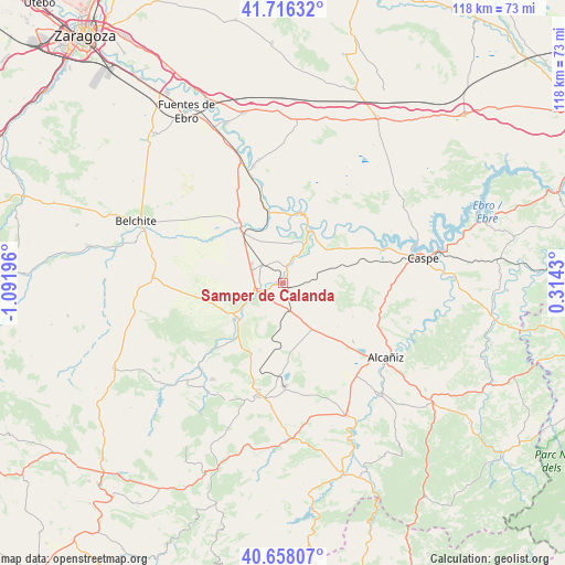
Samper de Calanda GPS coordinates[2]
41° 11' 21.588" North, 0° 23' 19.788" West
| Map corner | latitude | longitude |
|---|---|---|
| Upper-left | 41.71632°, | -1.09196° |
| Center: | 41.18933°, | -0.38883° |
| Lower-right: | 40.65807°, | 0.3143° |
| Map W x H: | 117.7×117.7 km | = 73.1×73.1mi |
| max Lat: | 43.74134° ⇑47.1% North |
| Samper de Calanda: | 41.18933° |
| min Lat: | ⇓52.9% South 27.64134° |
| min Long | Samper de Calan | max Long |
| -18.00367° | -0.38883° | 4.2899° |
| W 83.3%⇐ | ⇒16.7% E |
Elevation
Elevation of Samper de Calanda is 258 m = 846 ft, and this is 340 m = 1115 ft below average elevation for this country.
| Max E: |
1682 m = 5518 ft | 77.9% |
| Avg. | 598 m = 1962 ft | |
| Samper de Calanda | 258 m = 846 ft | |
Min E: |
0 m = 0 ft | 22.1% |
See also: Spain elevation on elevation.city.
Geographical zone
Samper de Calanda is located in North temperate zone (between Tropic of Cancer and the Arctic Circle). Distance of this Northern Tropic circle is 1973.9 km =1226.5 mi to South.| Distance of | km | miles | from Samper de Calanda |
|---|---|---|---|
| North Pole | 5427.2 | 3372.3 | to North |
| Arctic Circle | 2821.3 | 1753.1 | to North |
| Tropic Cancer | 1973.9 | 1226.5 | to South |
| Equator | 4579.8 | 2845.8 | to South |


Nearby cities:
15 places around Samper de Calanda: (largest is in red/bold)
• Albalate del Arzobispo
12.7 km =7.9 mi,  233°
233°
• Alborge
16.3 km =10.1 mi,  9°
9°
• Alforque
15.6 km =9.7 mi,  1°
1°
• Almochuel
16.9 km =10.5 mi,  306°
306°
• Andorra
24.2 km =15 mi,  191°
191°
• Castelnou
4.9 km =3 mi,  24°
24°
• Chiprana
23.4 km =14.5 mi,  69°
69°
• Cinco Olivas
16.8 km =10.4 mi, 5°
• Escatrón
12.6 km =7.8 mi,  25°
25°
• Híjar
5.5 km =3.4 mi,  252°
252°
• Jatiel
3.5 km =2.2 mi, 9°
• La Puebla de Híjar
5.7 km =3.5 mi, 309°
• La Zaida
15.7 km =9.8 mi,  347°
347°
• Sástago
15.1 km =9.4 mi, 12°
• Velilla de Ebro
20.9 km =13 mi, 349°
Sources, notices
• [Note1] Compared only with cities in Spain existing in our database
• [Src1] Map data: © OpenStreetMap contributors (CC-BY-SA)
• [Src2] Other city data from geonames.org with taken over terms of usage.
• [Src3] Geographical zone / Annual Mean Temperature by Robert A. Rohde @ Wikipedia
