Escatrón geodata
Escatrón (Aragon) is a seat of a third-order administrative division; located in Spain in Europe/Madrid (GMT+2) time zone. With population of 1,145 people, there are 2777 cities with bigger population in this country. Compared to other cities in Spain, 55.2% of cities are located further ↓South; 84.3% of cities are located further ←West and 83.8% of cities have higher elevation than Escatrón. Note1


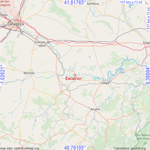
Escatrón GPS coordinates[2]
41° 17' 29.364" North, 0° 19' 23.088" West
| Map corner | latitude | longitude |
|---|---|---|
| Upper-left | 41.81765°, | -1.02621° |
| Center: | 41.29149°, | -0.32308° |
| Lower-right: | 40.76105°, | 0.38004° |
| Map W x H: | 117.5×117.5 km | = 73×73mi |
| max Lat: | 43.74134° ⇑44.8% North |
| Escatrón: | 41.29149° |
| min Lat: | ⇓55.2% South 27.64134° |
| min Long | Escatrón | max Long |
| -18.00367° | -0.32308° | 4.2899° |
| W 84.3%⇐ | ⇒15.7% E |
Elevation
Elevation of Escatrón is 158 m = 518 ft, and this is 440 m = 1444 ft below average elevation for this country.
| Max E: |
1682 m = 5518 ft | 83.8% |
| Avg. | 598 m = 1962 ft | |
| Escatrón | 158 m = 518 ft | |
Min E: |
0 m = 0 ft | 16.2% |
See also: Spain elevation on elevation.city.
Geographical zone
Escatrón is located in North temperate zone (between Tropic of Cancer and the Arctic Circle). Distance of this Northern Tropic circle is 1985.3 km =1233.6 mi to South.| Distance of | km | miles | from Escatrón |
|---|---|---|---|
| North Pole | 5415.9 | 3365.3 | to North |
| Arctic Circle | 2810 | 1746.1 | to North |
| Tropic Cancer | 1985.3 | 1233.6 | to South |
| Equator | 4591.2 | 2852.8 | to South |


Nearby cities:
15 places around Escatrón: (largest is in red/bold)
• Alborge
5.5 km =3.4 mi,  329°
329°
• Alforque
6.7 km =4.2 mi,  309°
309°
• Almochuel
19.1 km =11.9 mi,  266°
266°
• Castelnou
7.8 km =4.8 mi,  206°
206°
• Chiprana
16.7 km =10.4 mi,  100°
100°
• Cinco Olivas
6.7 km =4.2 mi,  323°
323°
• Gelsa
17.3 km =10.7 mi, 318°
• Híjar
16.9 km =10.5 mi,  219°
219°
• Jatiel
9.3 km =5.8 mi, 211°
• La Puebla de Híjar
12.5 km =7.8 mi,  231°
231°
• La Zaida
9.7 km =6 mi,  294°
294°
• Quinto
20.6 km =12.8 mi, 315°
• Samper de Calanda
12.6 km =7.8 mi, 205°
• Sástago
4.1 km =2.5 mi, 325°
• Velilla de Ebro
13.1 km =8.1 mi, 314°
Sources, notices
• [Note1] Compared only with cities in Spain existing in our database
• [Src1] Map data: © OpenStreetMap contributors (CC-BY-SA)
• [Src2] Other city data from geonames.org with taken over terms of usage.
• [Src3] Geographical zone / Annual Mean Temperature by Robert A. Rohde @ Wikipedia
