Albalate del Arzobispo geodata
Albalate del Arzobispo (Aragon) is a seat of a third-order administrative division; located in Spain in Europe/Madrid (GMT+2) time zone. With population of 2,163 people, there are 2072 cities with bigger population in this country. Compared to other cities in Spain, 51.5% of cities are located further ↓South; 81.6% of cities are located further ←West and 71.6% of cities have higher elevation than Albalate del Arzobispo. Note1
Administrative division(s):
- Level 1: Aragon
- Level 2: Provincia de Teruel
- Level 3: Albalate del Arzobispo


Albalate del Arzobispo GPS coordinates[2]
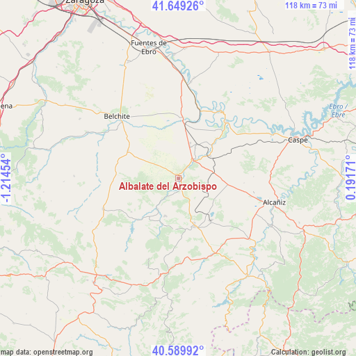
41° 7' 18.228" North, 0° 30' 41.112" West
| Map corner | latitude | longitude |
|---|---|---|
| Upper-left | 41.64926°, | -1.21454° |
| Center: | 41.12173°, | -0.51142° |
| Lower-right: | 40.58992°, | 0.19171° |
| Map W x H: | 117.8×117.8 km | = 73.2×73.2mi |
| max Lat: | 43.74134° ⇑48.5% North |
| Albalate del Arzobispo: | 41.12173° |
| min Lat: | ⇓51.5% South 27.64134° |
| min Long | Albalate del Ar | max Long |
| -18.00367° | -0.51142° | 4.2899° |
| W 81.6%⇐ | ⇒18.4% E |
Elevation
Elevation of Albalate del Arzobispo is 355 m = 1165 ft, and this is 243 m = 797 ft below average elevation for this country.
| Max E: |
1682 m = 5518 ft | 71.6% |
| Avg. | 598 m = 1962 ft | |
| Albalate del Arzobispo | 355 m = 1165 ft | |
Min E: |
0 m = 0 ft | 28.4% |
See also: Spain elevation on elevation.city.
Geographical zone
Albalate del Arzobispo is located in North temperate zone (between Tropic of Cancer and the Arctic Circle). Distance of this Northern Tropic circle is 1966.4 km =1221.9 mi to South.| Distance of | km | miles | from Albalate del Arzobispo |
|---|---|---|---|
| North Pole | 5434.8 | 3377 | to North |
| Arctic Circle | 2828.9 | 1757.8 | to North |
| Tropic Cancer | 1966.4 | 1221.9 | to South |
| Equator | 4572.3 | 2841.1 | to South |


Nearby cities:
15 places around Albalate del Arzobispo: (largest is in red/bold)
• Alacón
18.9 km =11.7 mi,  235°
235°
• Alcaine
24.8 km =15.4 mi,  221°
221°
• Alloza
17 km =10.6 mi,  185°
185°
• Almochuel
17.9 km =11.1 mi,  349°
349°
• Andorra
17 km =10.6 mi,  161°
161°
• Ariño
12.2 km =7.6 mi,  213°
213°
• Castelnou
17.1 km =10.6 mi,  45°
45°
• Escatrón
24.6 km =15.3 mi,  39°
39°
• Híjar
7.7 km =4.8 mi, 40°
• Jatiel
15.4 km =9.6 mi, 44°
• La Puebla de Híjar
12.6 km =7.8 mi,  27°
27°
• La Zaida
23.9 km =14.9 mi,  16°
16°
• Lécera
19.1 km =11.9 mi,  298°
298°
• Oliete
19.4 km =12.1 mi, 224°
• Samper de Calanda
12.7 km =7.9 mi, 53°
Sources, notices
• [Note1] Compared only with cities in Spain existing in our database
• [Src1] Map data: © OpenStreetMap contributors (CC-BY-SA)
• [Src2] Other city data from geonames.org with taken over terms of usage.
• [Src3] Geographical zone / Annual Mean Temperature by Robert A. Rohde @ Wikipedia
